236 Cuerdas Naguabo | Direct Express Access
$1,800,000
229.2 ac
Your take
What do you like?
Scout suggestions are outlined. Your choices are filled.
Notes
No notes yet.
Scout suggestion
229.2-acre property with acreage.
- Land only — no move-in-ready home.
- The existing structure is not move-in ready.
Listing detailsPrice, facts & description
| Location | Maizales, Naguabo |
|---|---|
| Asking price | $1,800,000 |
| Property | Land only |
| Land | 229.2 acres |
| Property type | Land |
| Photos | 6 reported by Clasificados · 6 available here |
| Listing agent | 787-236-9560 |
Description from Clasificados
Source title: 236 Cuerdas Naguabo | Acceso Directo Expreso
FINCA LA FORTUNA—UNIQUE INVESTMENT OPPORTUNITY IN NAGUABO. Seeking large-scale agricultural property with unbeatable connectivity and multifaceted potential? Your opportunity is here. Finca La Fortuna, with 236 cuerdas (~229 acres) in Naguabo, is one of the most versatile and best-located properties in eastern Puerto Rico. Location and Unbeatable Access: Direct frontage on PR-53 and PR-31 offers immediate access for logistics, equipment movement, and exceptional visibility. Terrain with Unlimited Potential: • 143 Cuerdas Flat: Ideal for mechanized agriculture, extensive crops, or a large-scale solar energy project. • 93 Cuerdas Gentle Hills: Perfect for livestock, fruit trees, agroforestry, or low-density residential development. Infrastructure and Uses: • Agricultural Zoning (A-1/A-G). Ideal for qualifying for incentives. • Water and electric services adjacent to the property. • Potential for: Commercial agriculture, livestock, solar projects (excellent for leasing), agritourism, or land banking. Invest in a unique property. Primary connectivity, versatile topography, and a promising future.
FINCA LA FORTUNA - OPORTUNIDAD ÚNICA DE INVERSIÓN EN NAGUABO ¿Busca una propiedad agrícola de gran escala con conectividad inmejorable y potencial multifacético? Su oportunidad está aquí. Finca La Fortuna, con 236 cuerdas (˜229 acres) en Naguabo, es una de las propiedades más versátiles y mejor ubicadas del este de Puerto Rico. Ubicación y Acceso Inmejorable: Con fachada directa a la PR-53 y PR-31,ofrece acceso inmediato para logística, movimiento de equipo y visibilidad excepcional. Terreno con Potencial Ilimitado: •143 Cuerdas Planas: Ideales para agricultura mecanizada, cultivos extensivos o el desarrollo de un gran proyecto de energía solar. •93 Cuerdas de Colinas Suaves: Perfectas para ganadería, frutales, agroforestería o desarrollo residencial de baja densidad. Infraestructura y Usos: •Zonificación Agrícola (A-1/A-G). Ideal para calificar para incentivos. •Servicios de agua y electricidad adyacentes a la propiedad. •Potencial para: Agricultura comercial, Ganadería, Proyectos Solares (excelente para arrendamiento), Agroturismo o Land Banking. Invierta en una propiedad única. Conectividad principal, topografía versátil y un futuro prometedor. CONTACTO: Héctor Báez| Lic. C-17995 787-236-9560 Puerto Rico
Location & driveMap, terrain & destinations
Location, terrain & flood
📍 Open in Google Maps — Maizales, Naguabo, Puerto Rico 👁 Street View 🛰 Satellite
⛰ 301 ft elevation 🌊 FEMA Zone X — minimal flood
Barrio-level pin (listings give barrio + municipio, not the exact lot) — verify the parcel location. Elevation: USGS. Flood zone: FEMA NFHL.
Drive times
| Miramar Bar | 20 min | 12.9 mi |
|---|---|---|
| Playa Lucía Disc Golf | 24 min | 17.6 mi |
| Albergue Olímpico Disc Golf | 83 min | 58.3 mi |
| SJU Airport | 66 min | 36.1 mi |
| Costco (Caguas) | 39 min | 21.4 mi |
CRIM & due diligenceParcel record & questions to verify
🏛️ CRIM property record
No parcel number is safely matched yet. The button opens the official map at the best listing location; confirm the parcel boundary before using its record.
🏛️ Open CRIM map near this property Paste an MLS address or CRIM number
A barrio or municipio pin is not precise enough to assign a CRIM record automatically.
Buildability
93 cuerdas of rolling hills and 143 cuerdas flat terrain are explicitly suitable for residential development; A-1/A-G zoning supports single-family building. Water and electric are adjacent. Main concern: scale and agricultural zoning may require variance for residential; flat section has potential flood exposure typical of eastern PR lowlands.
Questions to verify
- Confirm the 229-acre parcel boundary and CRIM cadastre record; verify no acreage or ownership discrepancies between listing and official records.
- If the couple is reconsidering and willing to develop land, verify zoning (A-1/A-G), utility stub locations, and eligibility for agricultural/Act 20/60 incentives claimed in listing.
- Clarify whether any residential dwelling, caretaker house, or habitable structure exists on the property not visible in aerial photos.
- Request survey, topographic, and soil report to assess the 143 flat cuerdas vs. 93 gentle-hill cuerdas breakdown and solar viability.
- Assess environmental constraints (wetlands, protected species, water rights) before major development or solar leasing.
Research & sourcesPhotos, web findings & original listing
What the photos show
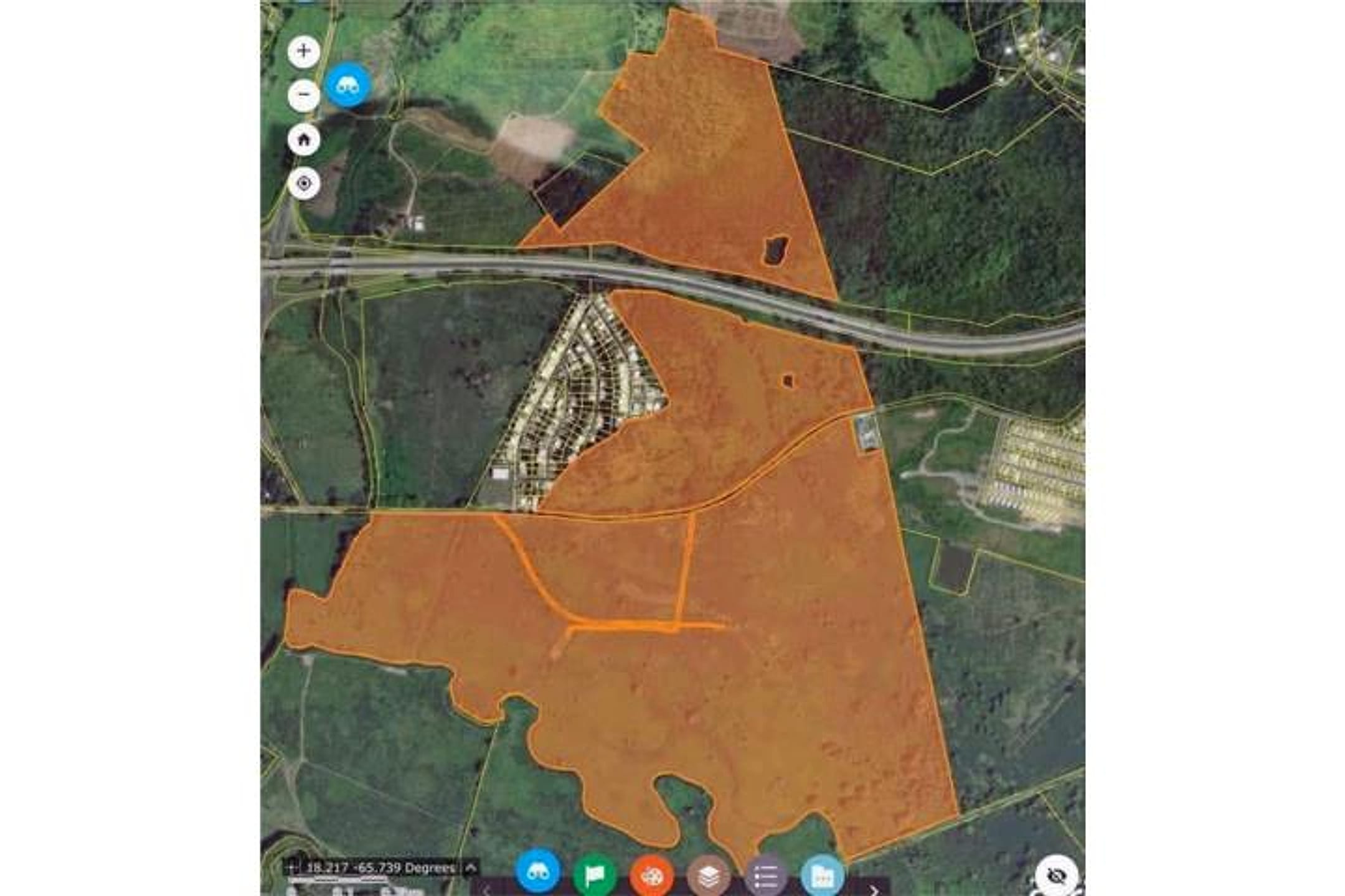
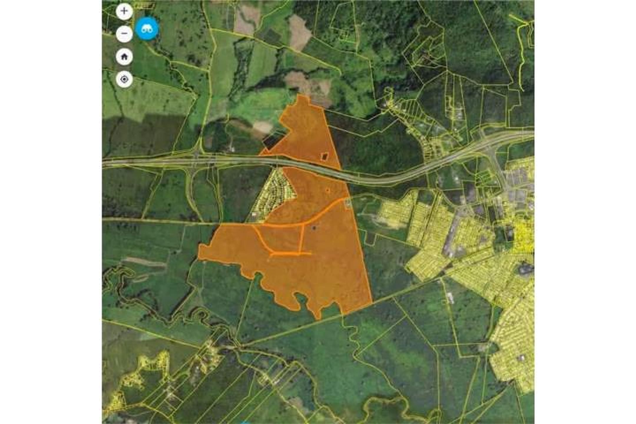
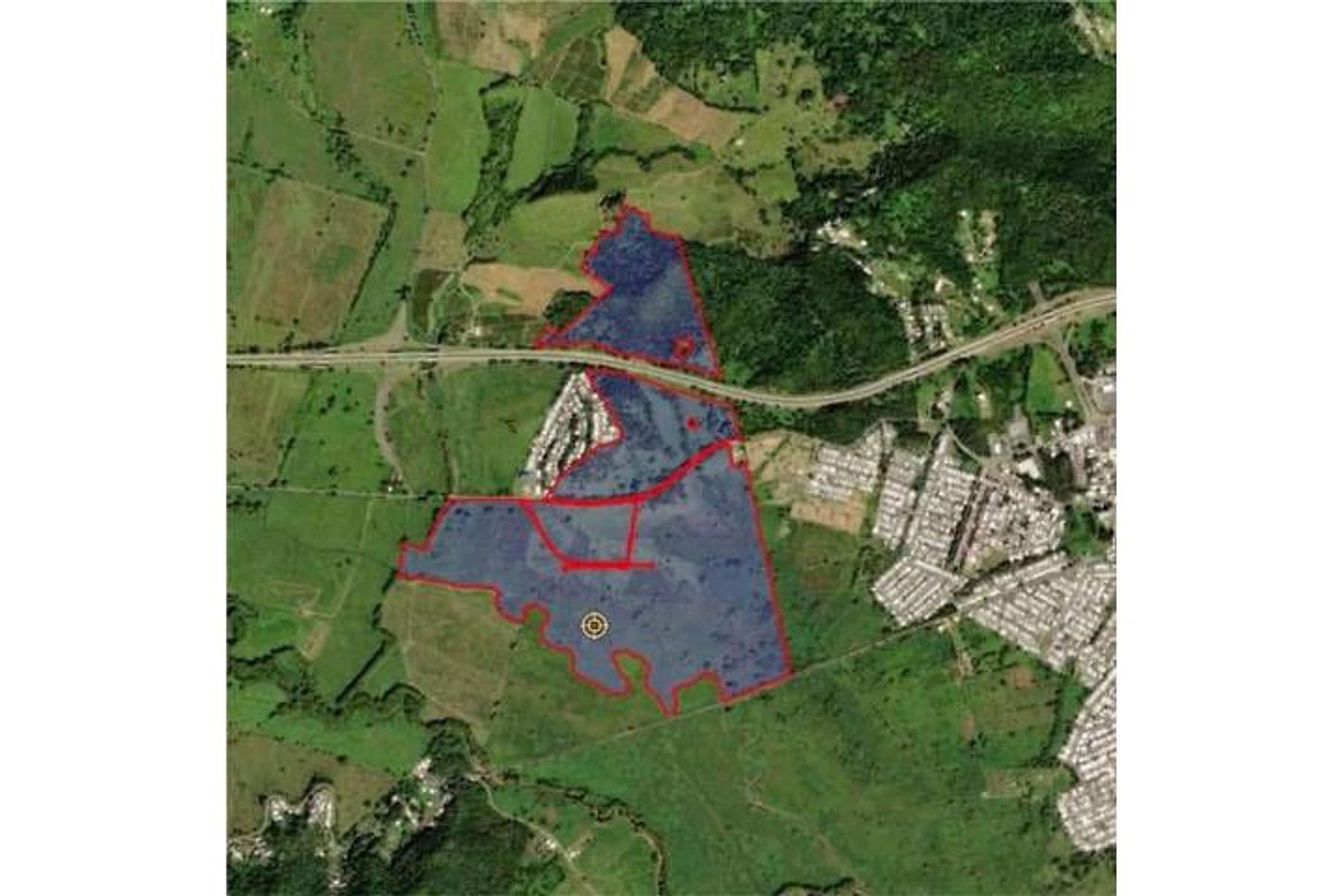
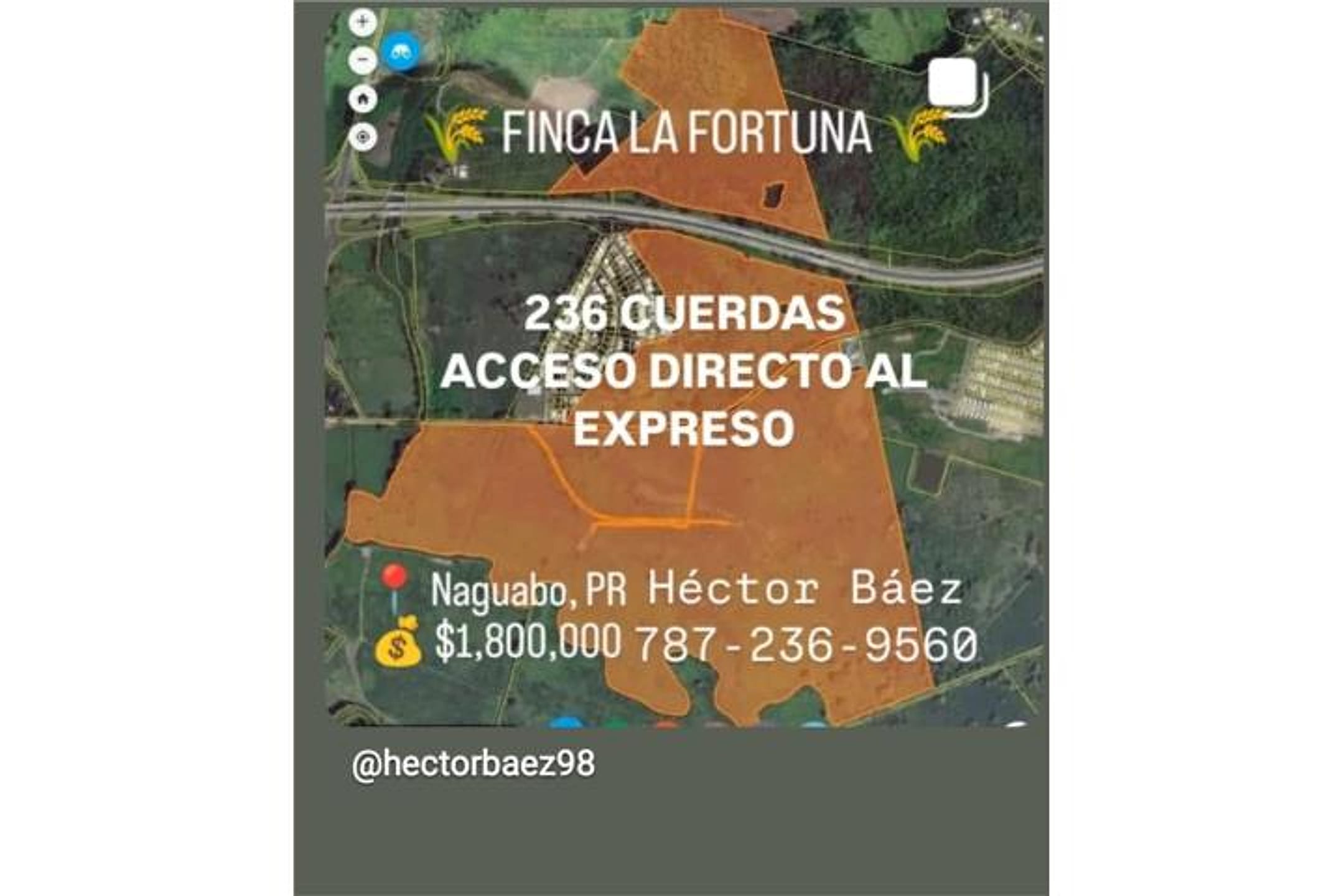
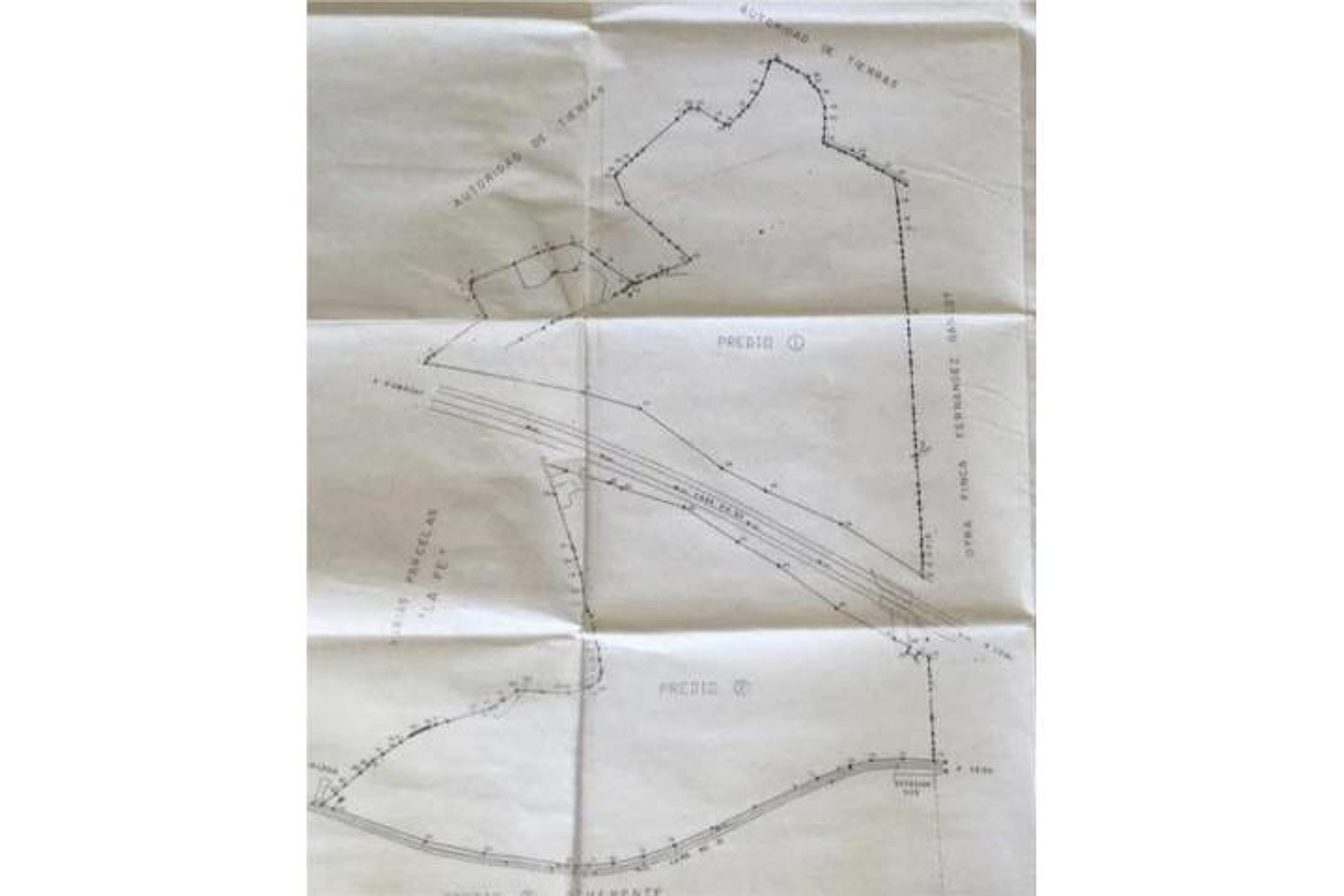
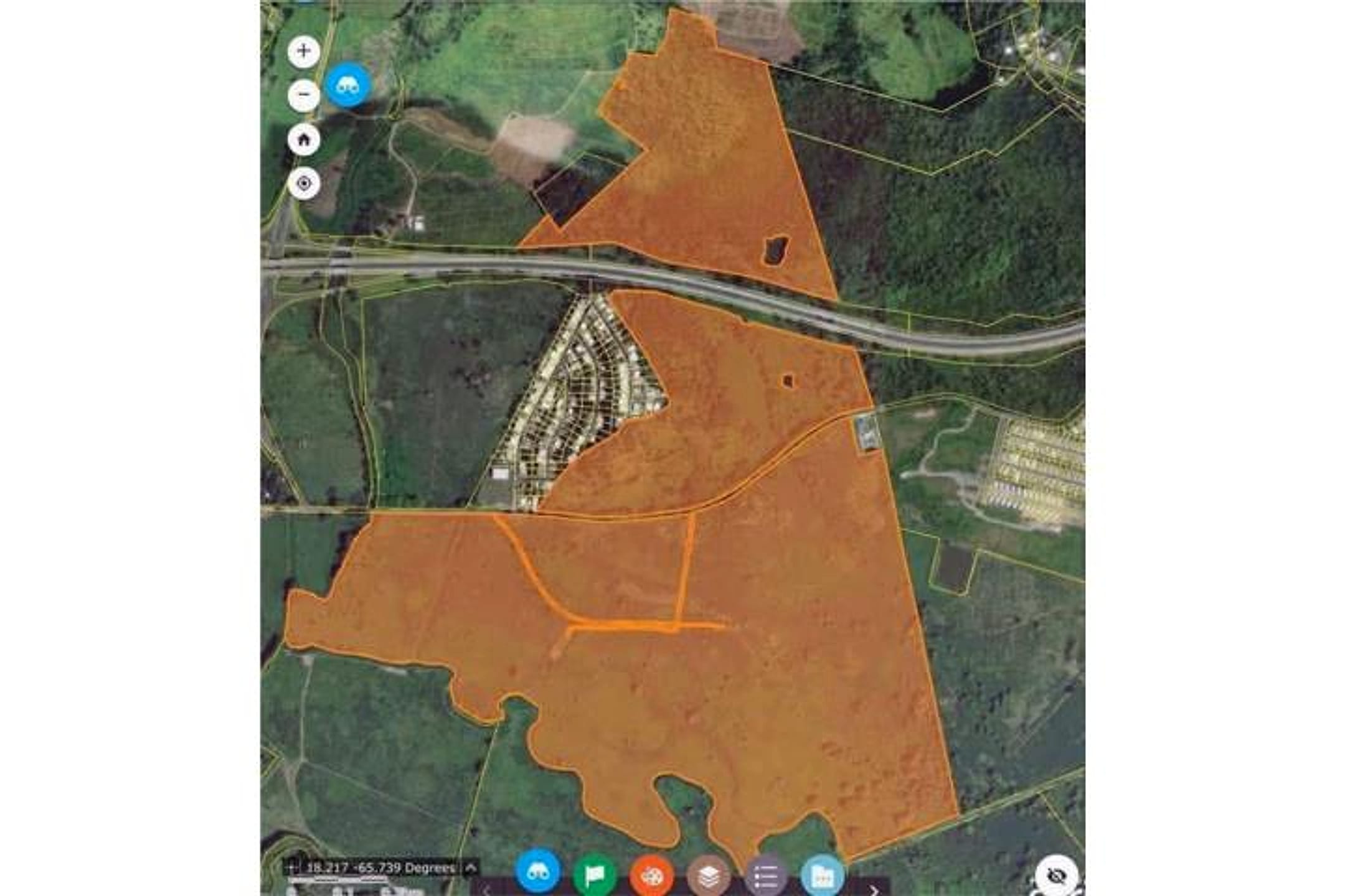
Photos 1, 2, 4, and 6 show the same large agricultural parcel from aerial view, with orange overlay marking ~229 acres of gently rolling terrain divided into flatter lowland sections and hillier zones. The property has direct road frontage on PR-53 (visible in multiple images) and is bordered by developed residential areas, pasture, and some scattered structures. Photo 3 appears to be a different property (purple overlay, denser vegetation, different landscape character) and should be disregarded. Photo 5 shows hand-drawn survey or topographic sketches—confirming the property has varied elevation. No dwelling, house, or residential structure is visible on the orange-outlined parcel itself; no fruit trees, water features (river/stream), or rainforest canopy are discernible at this resolution. The terrain shows pasture and cleared agricultural use, with surrounding green vegetation but no ocean or water body visible from the aerial perspective.
Scout-read from listing photos. Verify against the images.
Other things spotted in the photos
AI-read from the listing photos — unverified, eyeball against the actual photo before relying on it.
- Address:
Naguabo, PR— Location text in photo 4 - Note:
236 CUERDAS— Land area measurement in photo 4
What the web found
The specific 236-cuerda parcel listed on ClasificadosOnline (ID 4874064) does not appear on major U.S. real estate platforms. Comparable land in Naguabo ranges from $100,000 to $1.6M depending on size and location; a 53-acre parcel on Carr 3 Bennington Rd sold for $1.6M. The region faces hurricane and flood risks common to southeast Puerto Rico.
Also found online:
- Trulia — 53 acres at Carr 3 Bennington Rd, Naguabo listed at $1,600,000 by Enjolie Hernandez Real Estate
- FinditPR — Multiple Naguabo land listings available; similar-sized properties range from $100K to $1.2M
- Zillow — Land listings in Naguabo available but this specific parcel not found
Area intel: Naguabo land sales typically range $100K–$1.6M for parcels under 100 acres. The region is part of southeast Puerto Rico's coastal plains near El Yunque rainforest. Hurricane and flood risks are documented: Hurricane Hugo (1989) triggered landslides in eastern municipalities including Naguabo; Hurricane Maria (2017) caused significant damage to nearby Humacao. Building in the area requires hurricane-resistant construction. Terrain varies from flat coastal areas to some elevation inland. Proximity to Humacao (about 15 km south) provides market access.
What the sources contribute
Exact-property sources
- ClasificadosOnline primary listing · Aug 3, 2026 · 9 observations retained
$1,800,000 · 229.2 ac · 6 photos · 787-236-9560
Sources
Original listingGoogle itGoogle MapsStreet ViewSatellite viewRealtor.com compsPR flood map (FEMA)🏛️ CRIM map near listing (verify parcel)Clasificados ID 4874064 · added 2026-06-17