Cayey, Route 15, Kilometer 21.0
elevationmajestic viewsriverfrontprivate
Why it's interesting
Large acreage (27.65 acres) at excellent price ($4,521/acre, well under budget) in Cayey's beautiful Quebrada Arriba area with confirmed creek, elevation, and 'spectacular views' — ideal for building a dream home. However, no existing habitable structure means they must build; no mention of oceanView, rainforest character, or current infrastructure details; distance from Humacao is moderate (≈30–40 min), not a dealbreaker but not ideal.
| Location | Quebrada Arriba, Cayey (tier 2 — farther, “epic-only”) |
|---|---|
| Price | $250,000 |
| Size | 27.65 acres (28.47 cuerdas) |
| Land $/acre | $4,521/acre (after $125,000 home credit) |
| Fit score | 72/100 |
| Existing home | yes — not move-in habitable |
Location, terrain & flood
📍 Open in Google Maps — Quebrada Arriba, Cayey, Puerto Rico 🛰 Satellite
⛰ 2,160 ft elevation 🌊 FEMA Zone X — minimal flood
Barrio-level pin (listings give barrio + municipio, not the exact lot) — verify the parcel location. Elevation: USGS. Flood zone: FEMA NFHL.
Drive times
| Miramar Bar | 66 min | 36 mi |
|---|---|---|
| Playa Lucía Disc Golf | 69 min | 40.8 mi |
| SJU Airport | 64 min | 35.8 mi |
| Costco (Caguas) | 35 min | 16.3 mi |
Area & terrain notes
Cayey is a highland municipality in south-central Puerto Rico, elevation 1,000–2,000 ft, known for cool temperatures, lush terrain, and agricultural heritage (coffee, plantains). Quebrada Arriba ('Upper Creek') is a mountain barrio with natural water features and dramatic topography. It sits 30–40 minutes southeast of Humacao by car (roughly 20–25 miles), not immediately adjacent but within reasonable day-trip range. The area rarely floods in upland zones but creeks can swell in heavy rain; proximity to higher elevation reduces coastal/hurricane surge risk.
Buildability
Large enough and described as 'ideal for development' or agriculture/residence. Quebrada (creek) on-site is a major positive for water; verify road access (PR-15), flood zone clearance for the quebrada, and whether lot is outside agricultural protection restrictions. Topography likely steep near Cayey mountains—confirm buildable flat areas exist.
Due diligence — verify before buying
- Confirm access: Is PR-15 reliably maintained? Are there easement/right-of-way issues to build a driveway from the highway?
- Flood zone & creek: Obtain FEMA flood map and hydrological survey; verify the quebrada doesn't pose seasonal flooding or drainage liability for future home.
- Buildable land: Request a topographic survey to identify level areas suitable for a home, septic, and utilities; steep mountain terrain may limit usable footprint.
- Water & utilities: Does the property have potable water rights, or is rainwater/well-drilling required? What is electrical availability and cost to extend if needed?
- Zoning & agricultural restrictions: Confirm the land is not under agricultural protection status (Ley de Tierras Agrícolas) or other deed restrictions that would prevent residential construction.
- Title & survey: Obtain a current survey and title search to verify boundaries, ownership clarity, and no liens or easements that complicate development.
What the web found
The property is located on Route 15 in Cayey's southern region connecting to Guayama. Web sources show comparable land in the area ranging $38,000–$325,000 for smaller parcels; median property values in Cayey are $148,300. The area is mountainous with good road access but experienced hurricane-related landslides in 2017.
Also found online:
- Zillow — Shows 10 land listings in Cayey ranging 0.51–15.54 acres; prices $115,000–$198,900
- ByOwner.com — 26 properties in Cayey; 11 vacant land listings; land sales data available
- Trulia — Multiple land parcels listed, includes acreage ranges $38,000–$550,000
Area intel: Cayey median property value (2024): $148,300. Recent single-family home sales: $293,299–$520,139. Land pricing varies widely: 0.51–2.8 acres listed at $115,000–$160,000; larger parcels (8.4–15.54 acres) at $125,000–$198,900. At $250,000 for 27.65 acres, this listing equals ~$9,041/acre, above typical rural land rates but reasonable for mountain building. Route 15 is a rural secondary road. Area concerns: Cayey experienced significant landslides and 3,000 destroyed homes during Hurricane Maria (Sept 2017); elevation and steep terrain require building assessment. Climate: humid, average annual rainfall 100 inches.
Description (English)
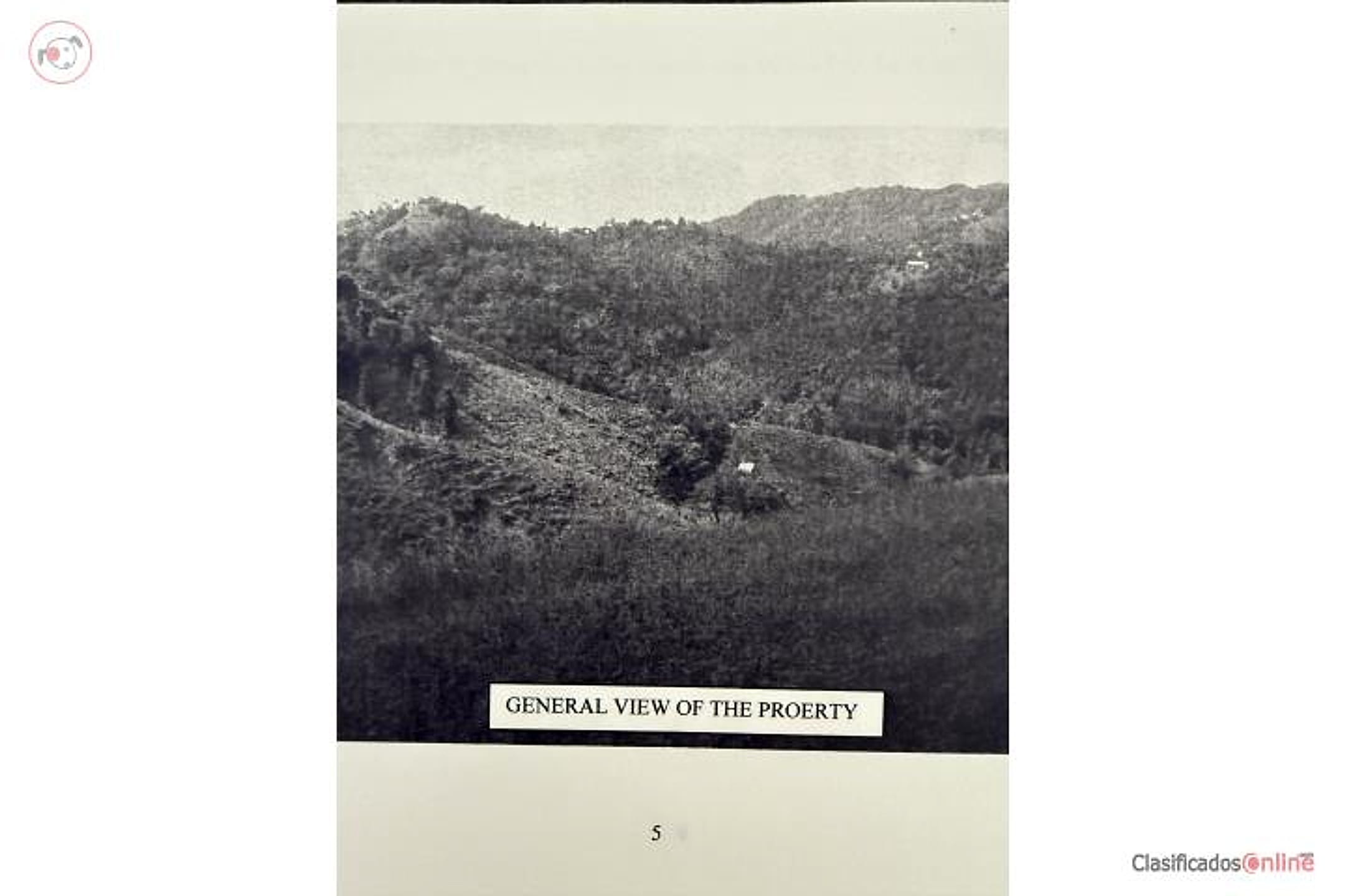
Quebrada Arriba, Route 15, Kilometer 21.0, Cayey — only 15 minutes from town. 28.47 cuerdas (27.65 acres). Creek running through the property, spectacular views. Ideal for development, agriculture, or residence. Excellent investment opportunity in one of Cayey's most beautiful areas.
Original Spanish
Luisa Claverol 7874599784 Quebrada Arriba Carr. 15 Kil.21.0, a solo 15 min . del pueblo . 28.47 cuerdas . Quebrada dentro de la propiedad , vistas espectaculares . Ideal para desarrollar , agricultura o residencia . Excelente oportunidad para inversión en una de áreas más hermosas de Cayey . Puerto Rico
Dig deeper
Original listingGoogle itGoogle MapsSatellite viewRealtor.com compsPR flood map (FEMA)Listing ID 4895470 · scored 2026-06-30 · AI-read