Strategic Investment: 8.64 Cuerdas in Aguas Buenas
elevationriverfrontprivaterainforest
Description from Clasificados
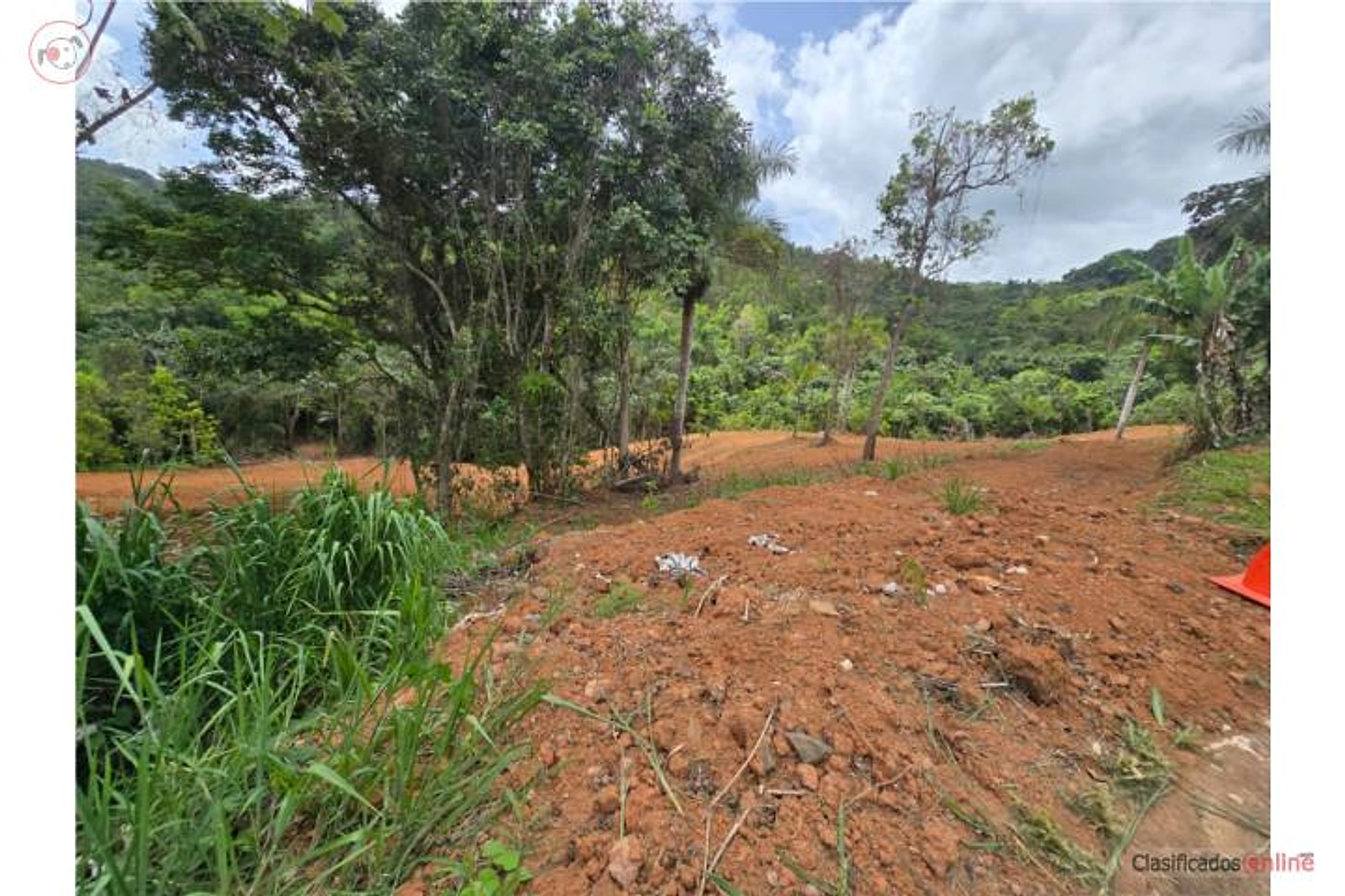
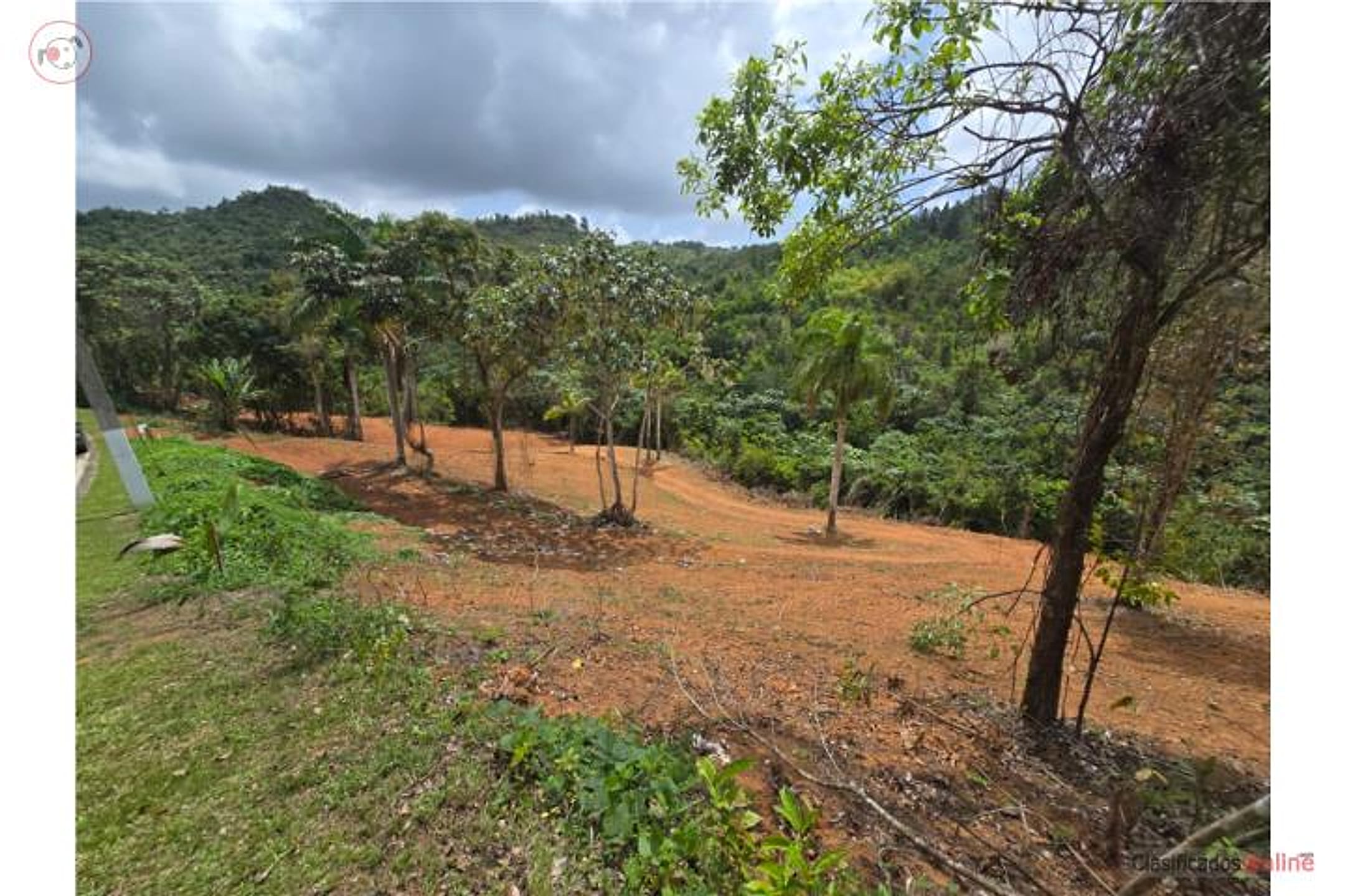
Land sale in the exclusive Estancia La Sierra II community, Aguas Buenas. Parcel: 33,910.81 m² (approximately 8.64 cuerdas / 8.39 acres). Price: $160,000. Semi-flat terrain with road access and connections to water and electricity. A clean stream crosses the property. Soil is fertile and productive; existing fruit trees and approximately 50 recently planted banana plants. Private, quiet setting surrounded by nature—ideal for those seeking spacious land to establish a family farm, grow their own food, or build the home of their dreams. Gated community with controlled access. Coordinates: 18.21756105, -66.10591194. Cash sale (proof of funds required to schedule viewing).
Original Spanish
Nuevo listado de terreno – Estancia La Sierra II, Aguas Buenas | $160,000 Se vende hermoso terreno de 33,910.81 metros cuadrados (aproximadamente 8.64 cuerdas) ubicado en la exclusiva comunidad Estancia La Sierra II en Aguas Buenas. Terreno semi llano, acceso a servicio de agua y energía eléctrica, quebrada de aguas limpias que atraviesa la propiedad, terreno fértil y productivo, algunos árboles frutales y recientemente se sembraron 50 matas de plátanos, entorno privado, tranquilo y rodeado de naturaleza. Esta propiedad es ideal para quienes ClasificadosOnline desean disfrutar de amplios espacios, establecer una finca familiar, cultivar sus propios alimentos o construir la residencia que siempre han soñado. El complejo cuenta con control de acceso. Coordenadas: 18.21756105, -66.10591194. Califica para venta Cash Evidencia de fondos requerida para coordinar visita. Para citas: Yenni Fernández Lic. C-24302/ E-405 787-221-5851/ 787-496-9000 Puerto Rico
Why it's interesting
The property delivers on elevation (1077 ft, good for the region), privacy (gated community, surrounded by nature/rainforest), and riverfront potential (listing mentions a clean stream, though not visible in photos). However, no ocean views are evident, fruit trees are minimal (mostly new plantings), and the terrain is semi-developed/cleared rather than pristine rainforest. At 1.6× the last recorded sale ($100k in April 2026), the $160k asking price is a notable premium; comparable Aguas Buenas land ranges $40–160k, so it sits at the high end. The property suits a building lot or farm but offers fewer "loves" than the list suggests.
🔄 Refreshed with measured elevation/flood, the cadastre record, and the listing photos on 2026-07-01.
💵 Asking price $160,000 is 1.6× the last recorded sale ($100,000 in April 2026); sits at the high end of Aguas Buenas comps ($40–160k). Verify if recent improvements or permits justify the premium.
What the photos show
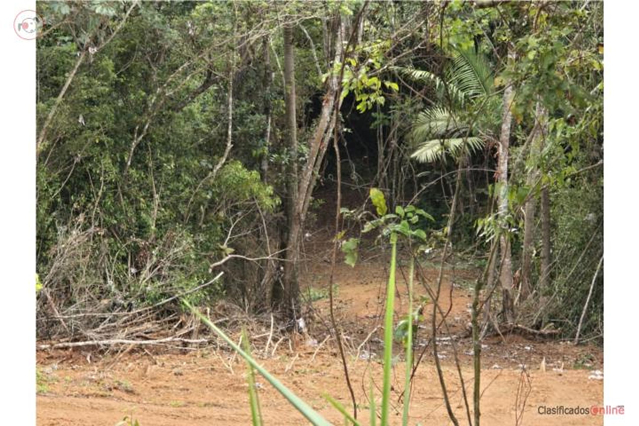
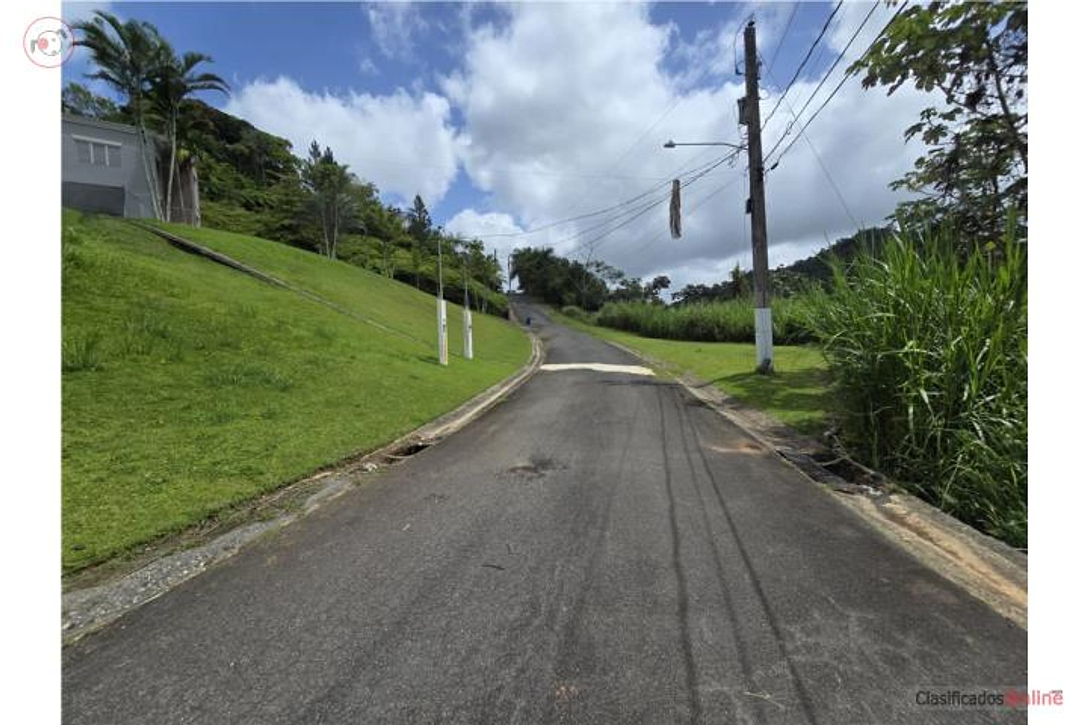
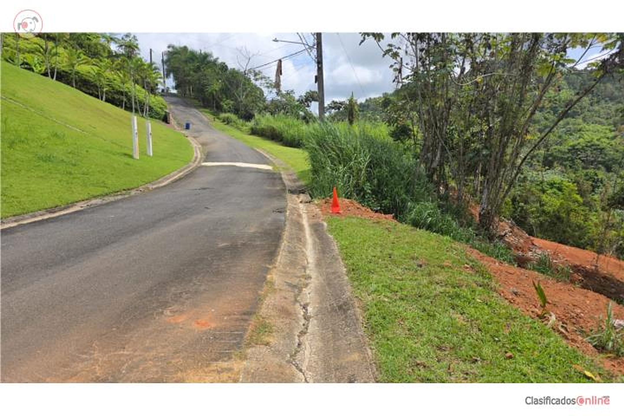
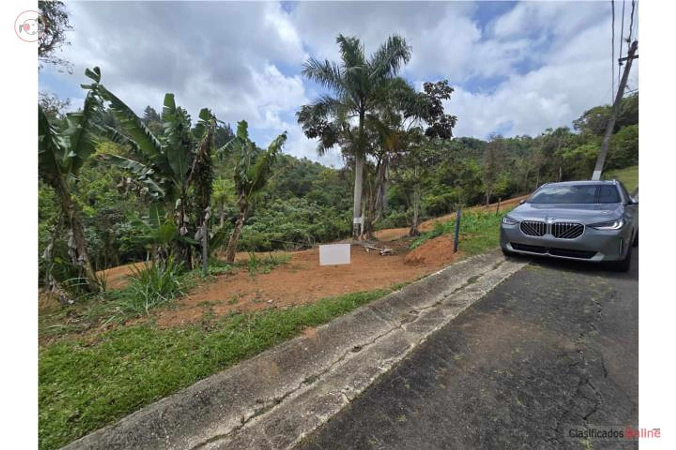
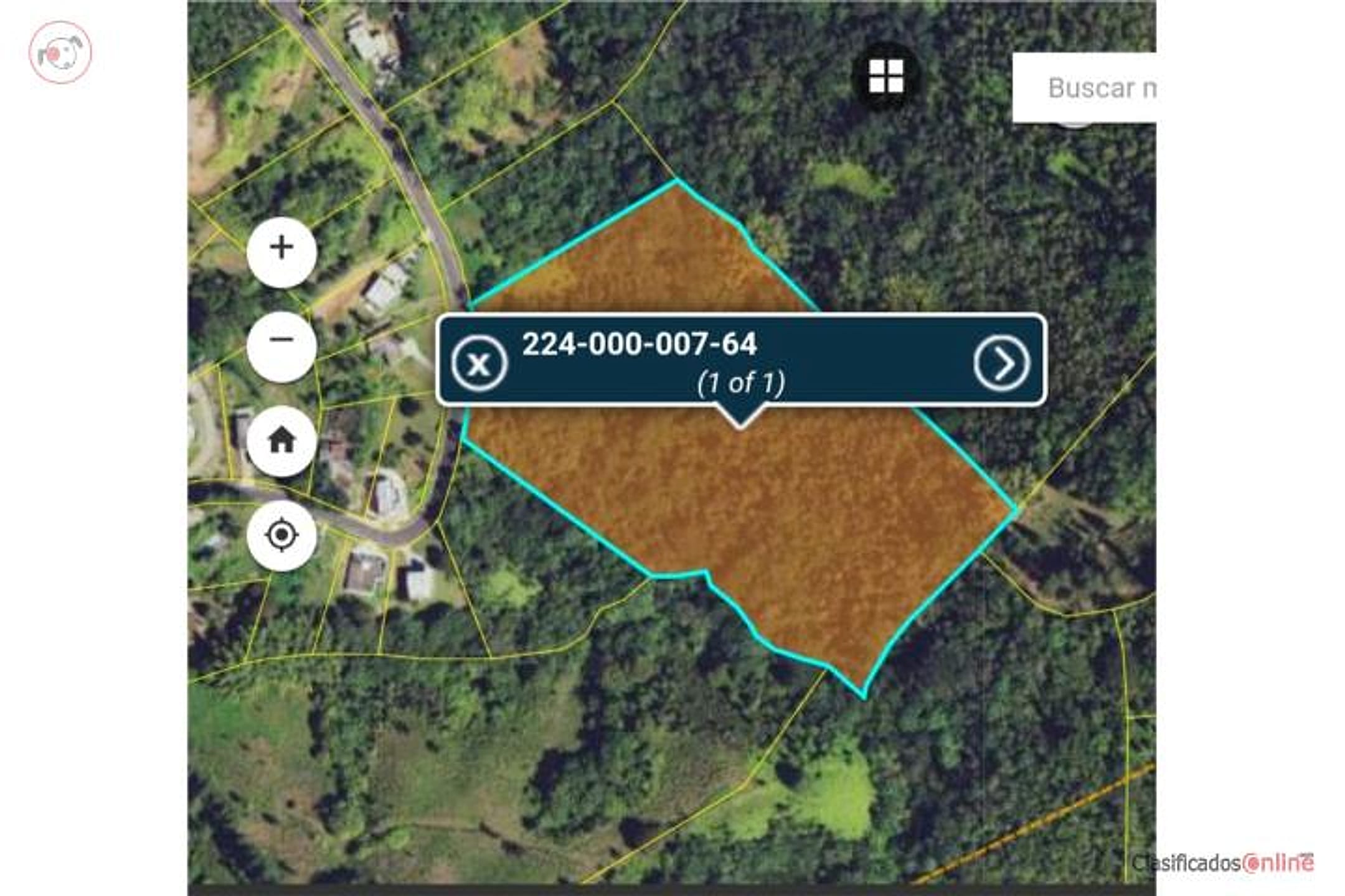
Photos 1–3 show raw, cleared red-earth parcels with scattered trees and dense rainforest backdrop—terrain is gently rolling, not flat as listed. Photos 4–6 reveal paved road access, manicured green surroundings, utility poles, and a parked car, confirming infrastructure in a gated community setting. Photo 3 shows tall native trees and dense understory, consistent with rainforest vegetation. Photo 7 is a cadastre map overlay showing the parcel boundary. No visible stream in any ground-level photo; no clear oceanview or distant vistas; no mature fruit trees visible, only recently planted banana plants mentioned in text. The property appears to be raw, undeveloped land suitable for building, with good road/utility access but no existing structures or established orchards.
Read from the listing photos by vision AI — verify against the images yourself.
| Location | Estancias De La Sierra, Aguas Buenas (tier 2 — farther, “epic-only”) |
|---|---|
| Price | $160,000 |
| Size | 8.39 acres (8.64 cuerdas) |
| Land $/acre | $9,535/acre (after $80,000 home credit) |
| Fit score | 62/100 |
| Existing home | yes — not move-in habitable |
🏛️ Official government record (CRIM cadastre)
| Parcela (catastro) | 224-000-007-64 |
|---|---|
| Owner of record | SOTO CABRERA HECTOR RAFAEL |
| Address (CRIM) | LA SIERRA II , SOLAR 62, PR, Puerto Rico, 00000 |
| Official surveyed size | 8.38 acres · 8.63 cuerdas · 33,919.27 m² |
| Last recorded sale | $100,000 on 2026-04-09 → bought by Hector Rafael Soto Cabrera (from ALISON M ORTEGA TORRES) ⚠️ asking 1.6× the last sale |
| Registry | Finca 13748 · Tomo 0 · Folio 0 · Escritura 5 |
| Assessed value | $601 total (land $601 + structure $0) — CRIM tax basis, not market value |
🏛️ Open in CRIM Catastro Digital
Pulled from the CRIM government cadastre using the parcel number read off a listing photo. Ownership & sale records are public; verify against the source before relying on them.
Location, terrain & flood
📍 Open in Google Maps — parcel 224-000-007-64 🛰 Satellite
⛰ 1,077 ft elevation 🌊 FEMA Zone X — minimal flood
Exact parcel boundary + centroid from the CRIM government cadastre. Elevation: USGS. Flood zone: FEMA NFHL.
Drive times
| Miramar Bar | 51 min | 29.8 mi |
|---|---|---|
| Playa Lucía Disc Golf | 55 min | 34.5 mi |
| SJU Airport | 44 min | 25 mi |
| Costco (Caguas) | 19 min | 8.9 mi |
Buildability
Semi-flat terrain and utilities (water, electric) on-site are favorable for single-family construction. Confirm zoning allows residential; verify floodplain status for the creek corridor and topographic constraints. Gated community infrastructure supports development.
Due diligence — verify before buying
- Locate and inspect the stream on-site; confirm water rights and flow year-round (Aguas Buenas is rain-dependent and subject to drought).
- Survey the property in person to assess the stream's buildability constraints (setbacks, flood risk during heavy rains given the 2017 Maria/landslide history).
- Clarify the location discrepancy: listing says 'Bo. Estancias De La Sierra' but cadastre (CRIM) records 'LA SIERRA II, SOLAR 62'—confirm the correct official address and verify no title encumbrances.
- Request proof of the current owner (Hector Rafael Soto Cabrera per CRIM); confirm the property is free of liens and the seller has clear marketable title.
- Walk the perimeter with the agent; photograph the stream, confirm road frontage, and check utility connections (water/electricity) are actually live and sufficient for building.
- Given Hurricane Maria damage history and the 2010 earthquake, request a professional geotechnical/soil stability assessment, especially on slopes and near the stream.
What the web found
Aguas Buenas is a mountainous municipality in the Central Mountain Range near but not immediately adjacent to Humacao. The municipality has experienced significant natural hazards including landslides from 2017's Hurricane Maria and a 2010 earthquake, which are relevant considerations for building. Limited comparable sales data found online; land prices in Aguas Buenas vary widely from roughly $40,000 to $160,000+ for multi-acre parcels.
Area intel: Aguas Buenas is in the Central Mountain Range with moderately mountainous terrain and average elevation of 337 m. Hurricane Maria in 2017 caused numerous landslides with significant damage to homes; the 2010 Nochebuena Earthquake affected the area. Comparable Aguas Buenas land listings show prices ranging from approximately $40,000–$160,000+ for parcels between 1–7 acres. Recent sales data on homes averaged $125,000, though land-only transactions vary.
Dig deeper
Original listingGoogle itGoogle MapsSatellite viewRealtor.com compsPR flood map (FEMA)Listing ID 4894368 · scored 2026-06-06 · keyword score, needs review