16-Cuerdas Land Parcel, Pasa Agua, Prime Location
private
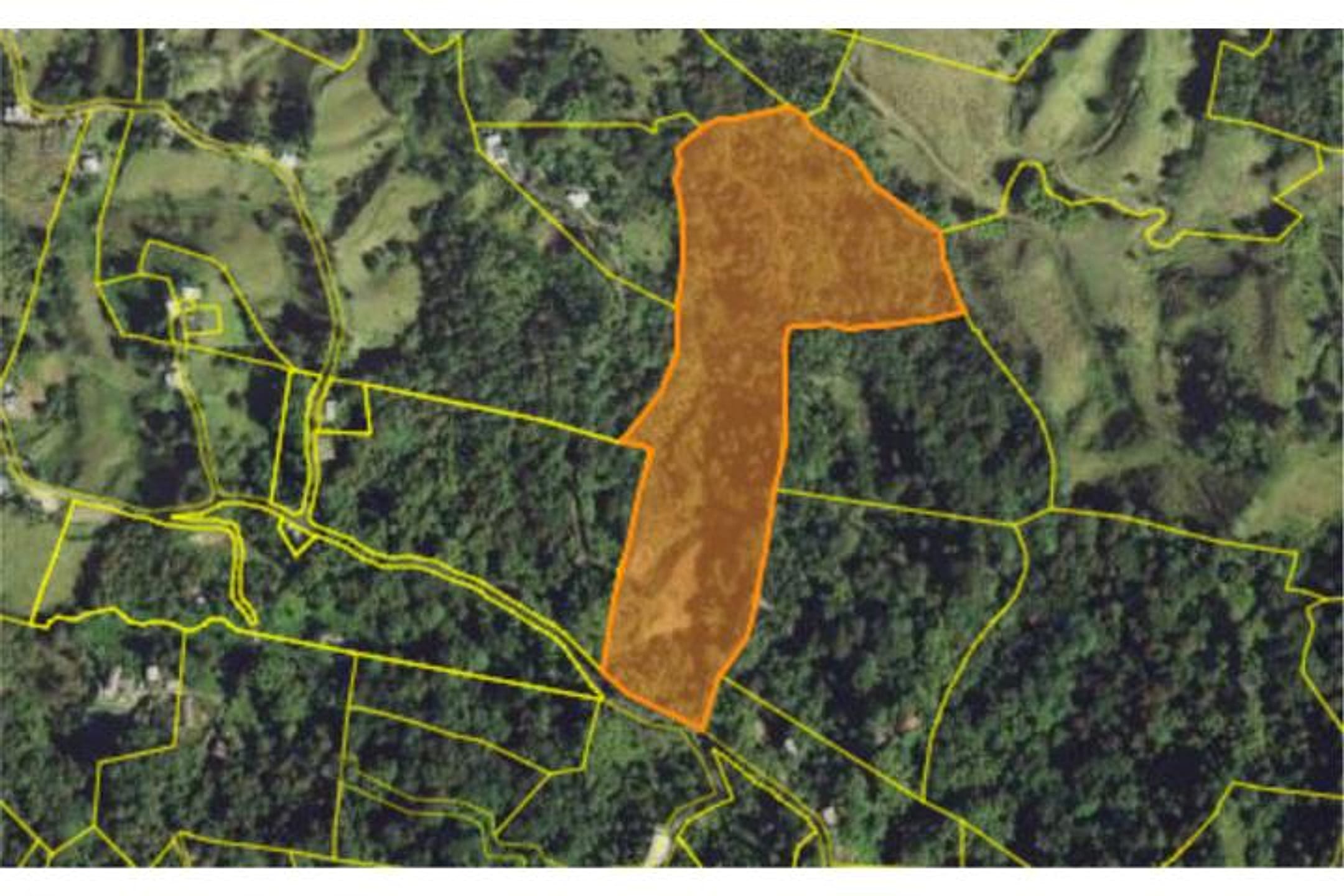
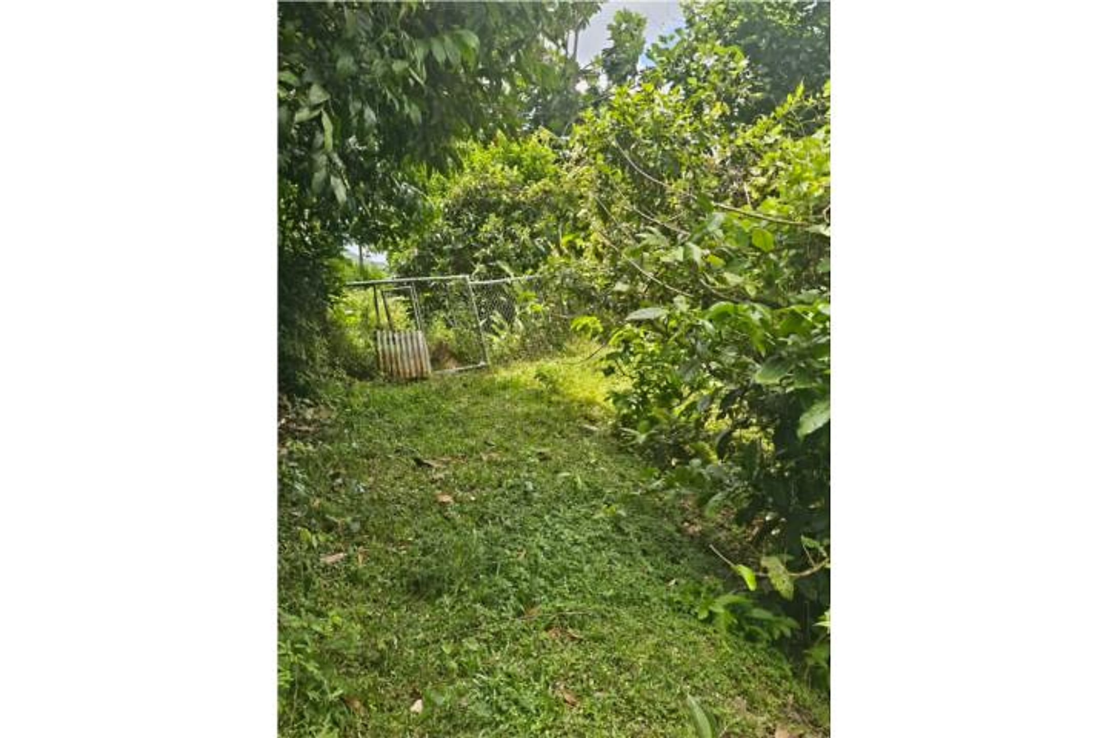
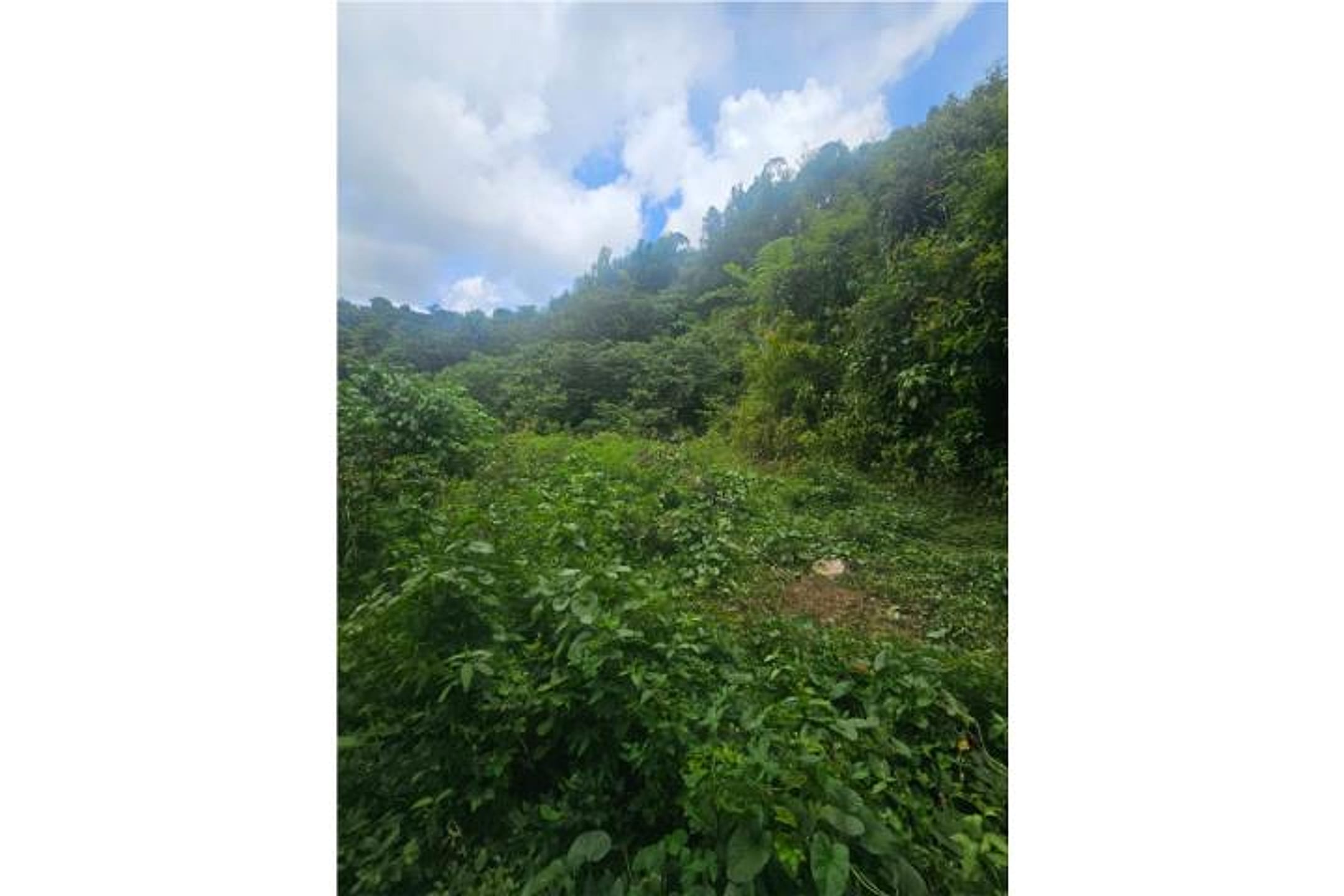
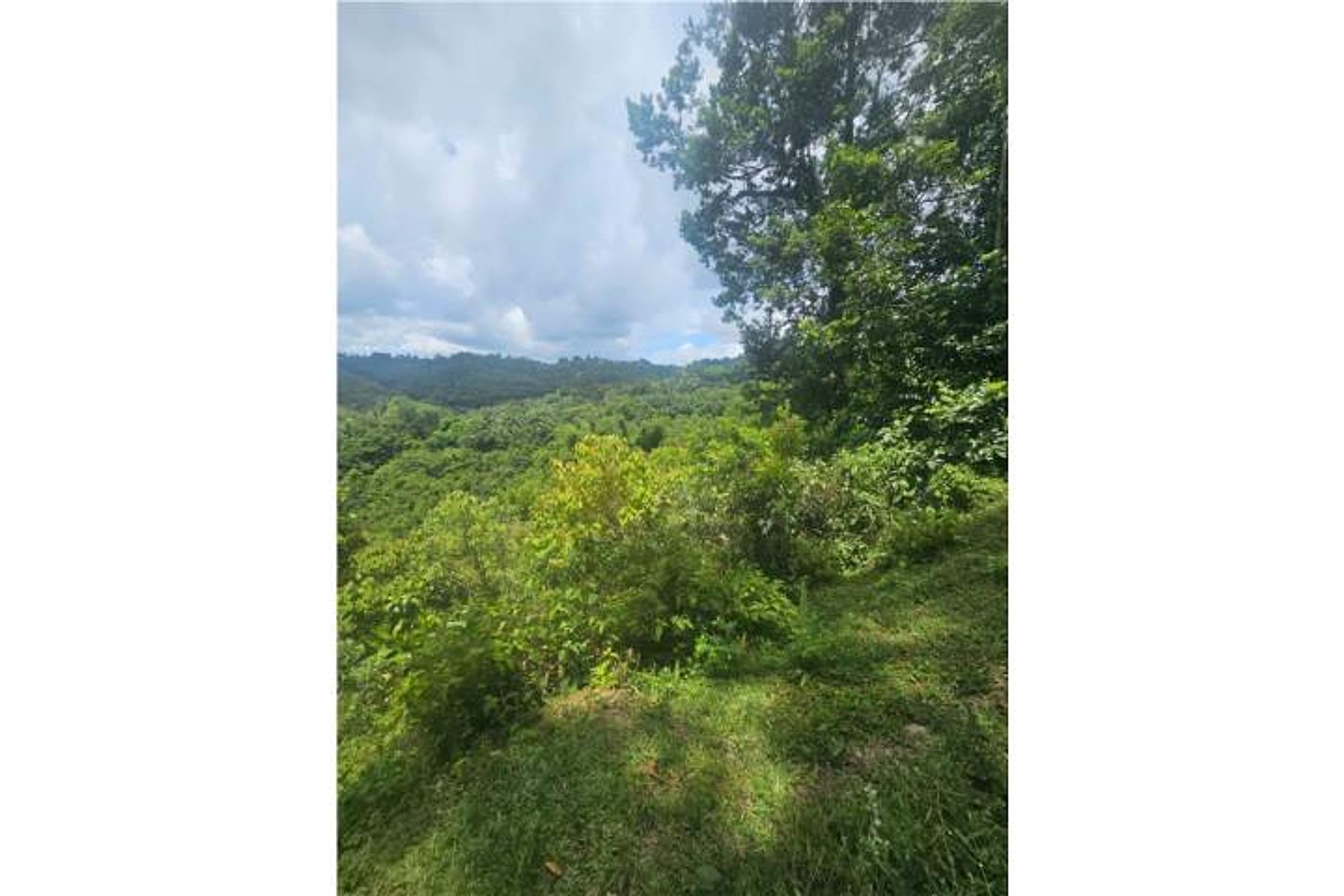
Description from Clasificados
Discover this impressive 16-cuerdas (15.54-acre) land parcel in Barrio Quebrada Arenas, perfect for developing your dream project or building your dream home with ample space and privacy. This paradise has all necessary amenities: water and electricity access, plus its own natural spring that adds invaluable value and a natural resource source. Imagine the possibilities: from a sustainable agricultural project to a country residence with spectacular views. Don't miss this unique opportunity to acquire a property with such potential in a privileged natural setting. Contact us today for more information and schedule your visit. Puerto Rico
Original Spanish
Descubre este impresionante terreno de 16 cuerdas en BO Quebrada Arenas, perfecto para desarrollar tu proyecto soñado o construir el hogar de tus sueños con amplio espacio y privacidad. Este paraíso cuenta con todas las facilidades necesarias: acceso a agua y luz, además de un manantial propio que añade un valor incalculable y una fuente de recursos naturales. Imagina las posibilidades: desde un proyecto agrícola sostenible hasta una residencia campestre con vistas espectaculares. ¡No dejes pasar esta oportunidad única de adquirir una propiedad con tanto potencial en un entorno natural privilegiado!Contáctanos hoy mismo para más información y agenda tu visita. Puerto Rico
Why it's interesting
Excellent land parcel at $3,539/acre (well under budget) in the right municipio with private water source, acreage, and privacy—classic dream-build foundation. The listing hints at 'spectral views' and natural setting but provides no elevation data, topography detail, or photos to confirm the majestic views they specifically want; this is the main gap.
| Location | Quebrada Arenas, San Lorenzo (tier 1 — preferred catchment) |
|---|---|
| Price | $110,000 |
| Size | 15.54 acres (16 cuerdas) |
| Land $/acre | $3,539/acre (after $55,000 home credit) |
| Fit score | 78/100 |
| Existing home | yes — not move-in habitable |
Location, terrain & flood
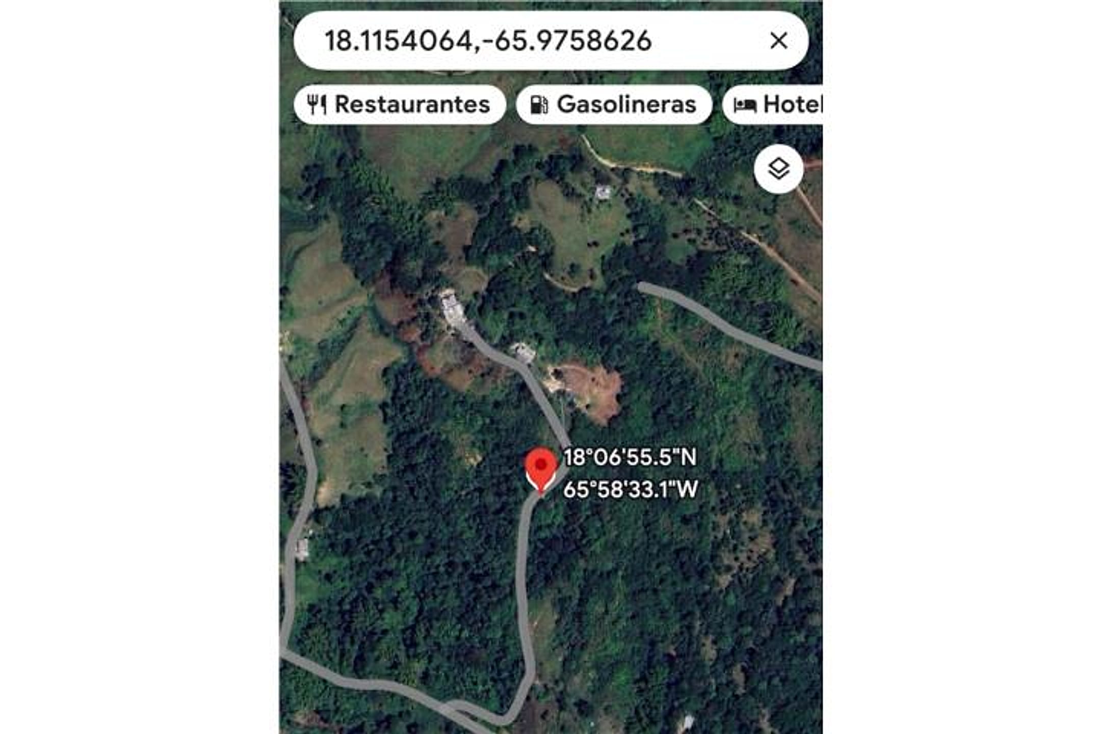
📍 Open in Google Maps — Quebrada Arenas, San Lorenzo, Puerto Rico 🛰 Satellite
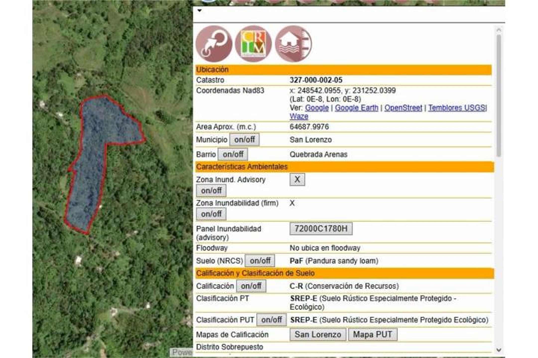
⛰ 947 ft elevation 🌊 FEMA Zone X — minimal flood
Barrio-level pin (listings give barrio + municipio, not the exact lot) — verify the parcel location. Elevation: USGS. Flood zone: FEMA NFHL.
Drive times
| Miramar Bar | 33 min | 16.4 mi |
|---|---|---|
| Playa Lucía Disc Golf | 25 min | 10.8 mi |
| Albergue Olímpico Disc Golf | 70 min | 39.6 mi |
| SJU Airport | 62 min | 37.3 mi |
| Costco (Caguas) | 31 min | 16.4 mi |
Area & terrain notes
San Lorenzo sits in the interior south-central region of Puerto Rico, inland from Humacao and El Yunque. The municipio is characterized by rolling to mountainous terrain with subtropical wet forest and karst features; elevation varies significantly depending on barrio placement. Quebrada Arenas and Pasa Agua are rural, forested areas known for natural springs and agricultural use. The region experiences moderate rainfall year-round and is generally outside major hurricane-flood corridors, though seasonal runoff can be relevant. Character is rural, agrarian, and quiet—consistent with their elevation and privacy preferences if topography confirms.
Buildability
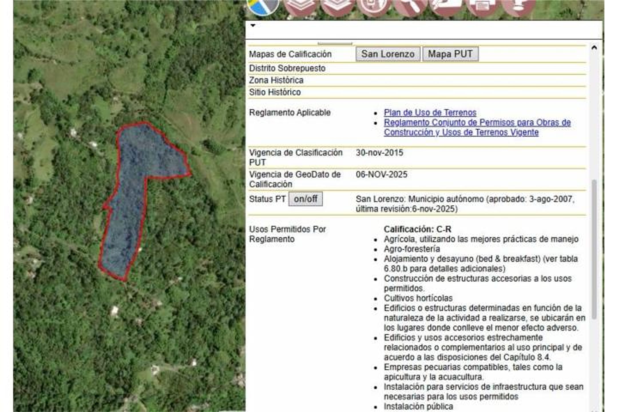
16 cuerdas (15.54 acres) offers ample single-family buildable area. Water and electricity confirmed on-site; private spring is a major asset. No mention of flood zone, agricultural restrictions, or easements—must verify before committing. Road access grade and surveyed boundaries are critical.
Due diligence — verify before buying
- Request aerial/satellite imagery and topographic map to verify actual elevation, slope aspect (views toward coast or mountains?), and whether 'spectral views' claim is real or marketing hyperbole.
- Confirm property flood zone (FEMA or PR hazard maps), especially given presence of spring and water drainage patterns on 15+ acres.
- Obtain survey and deed to verify exact boundaries, water rights (spring access and ownership permanence), and any easements or agricultural restrictions.
- Walk road access: confirm drivable condition, width, maintenance responsibility, and whether a second access exists (critical for emergency egress).
- Verify zoning classification (rural/agricultural/residential) and whether single-family home construction requires variance or agricultural waiver.
- Environmental check: confirm no protected wetlands, karst features blocking foundation, or endangered-species habitat on the parcel.
What the web found
Quebrada Arenas is a real barrio in San Lorenzo located in the eastern-central region of Puerto Rico, with USGS monitoring stations and various residential/agricultural properties. The area is mountainous, with riverside access and nearby recreation. Similar land parcels in Quebrada Arenas and San Lorenzo range from ~$55k–$150k+ depending on size; hurricane/landslide risk noted historically.
Also found online:
- PropertyShark / FindItPR — Multiple land listings in Quebrada Arenas, San Lorenzo; 4-acre parcel noted as excellent development opportunity in barrio Quebrada
- TotalCommercial.com — 114 cuerdas (~111 acres) agricultural land in Quebrada Arenas Ward; also smaller vacant residential lots with lush greenery and scenic views
- FindItPR / Findit.pr — Recent San Lorenzo land listings including Carr PR 9920 Km 1.2 Bo Quebrada Arenas; 19.8 acres for $220k (Km 4.6); 84.78 acres for $1.42M
- Homes.com Puerto Rico — Lot#1-A Los Colones Sector Quebrada Arenas Ward, San Juan area; $85k for 23,522 sq ft land
Area intel: Quebrada Arenas is a rural, mountainous barrio with 2,390 residents (2010 census). Comparable land sales in San Lorenzo range from $55k–$220k+ for 0.9–19.8 acres. Terrain is mixed (hills, flat areas, gentle slopes); accessible via PR-181 and local roads. Significant hazard: Hurricane María (Sept 2017) triggered numerous landslides in San Lorenzo due to heavy rainfall. San Lorenzo is on a batholith (igneous rock formation) bordered by Sierra de Luquillo to north and Sierra de Cayey to south. Water resources available (Río Grande de Loíza, Quebrada Arenas wells monitored by USGS). Area used for agriculture, livestock, and increasingly residential/investment properties. No major news alerts for this specific address or sector.
Dig deeper
Original listingGoogle itGoogle MapsSatellite viewRealtor.com compsPR flood map (FEMA)Listing ID 4861977 · scored 2026-06-06 · AI-read