16-Acre Land Parcel, Pasa Agua, Prime Location
elevationprivaterainforest
Description from Clasificados
Discover this impressive 16-acre (16 cuerdas) property in Barrio Clasificados Quebrada Arenas, perfect for developing your dream project or building your dream home with ample space and privacy. This natural paradise comes with all necessary utilities: water and electricity access, plus its own spring — a priceless asset and natural resource. Imagine the possibilities: from a sustainable agricultural project to a countryside residence with spectacular views. Don't miss this unique opportunity to acquire a property with so much potential in a privileged natural setting. Contact us today for more information and schedule your visit.
Original Spanish
Descubre este impresionante terreno de 16 cuerdas en BO Clasificados Quebrada Arenas, perfecto para desarrollar tu proyecto soñado o construir el hogar de tus sueños con amplio espacio y privacidad. Este paraíso cuenta con todas las facilidades necesarias: acceso a agua y luz, además de un manantial propio que añade un valor incalculable y una fuente de recursos naturales. Imagina las posibilidades: desde un proyecto agrícola sostenible hasta una residencia campestre con vistas espectaculares. ¡No dejes pasar esta oportunidad única de adquirir una propiedad con tanto potencial en un entorno natural privilegiado!Contáctanos hoy mismo para más información y agenda tu visita. Puerto Rico
Why it's interesting
The property offers solid fundamentals—low flood risk (Zone X), mountain elevation (947 ft), water access (own spring, utilities confirmed), and privacy in a rural setting—but ground-level photos show dense, undeveloped forest with no visible elevation gain, views, oceanfront, or riverfront within the parcel itself. At $110k for 15.54 acres (~$7k/acre) it is modestly priced for rural Puerto Rico comps ($55k–$220k range) and near the lower end, suggesting fair to good value; however, the lack of panoramic vistas or water features visible in photos, combined with Hurricane María landslide risk in the region, makes this a speculative land play rather than a move-in or scenic dream-home site.
🔄 Refreshed with measured elevation/flood, the cadastre record, and the listing photos on 2026-07-01.
💵 Last sale/price history not provided in images; $110k at ~$7k/acre is in the lower-to-mid range for San Lorenzo comps—appears fairly priced if utilities and spring access are verified.
What the photos show
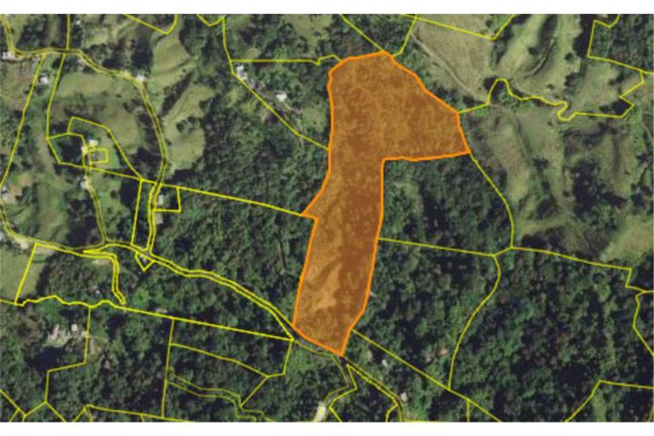
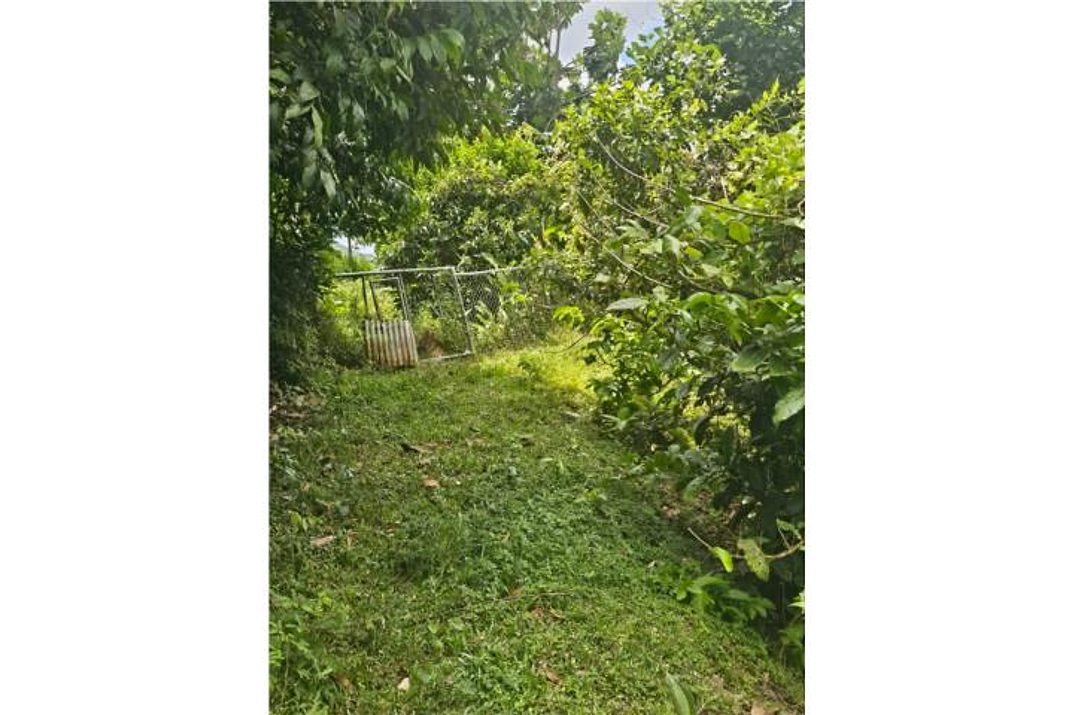
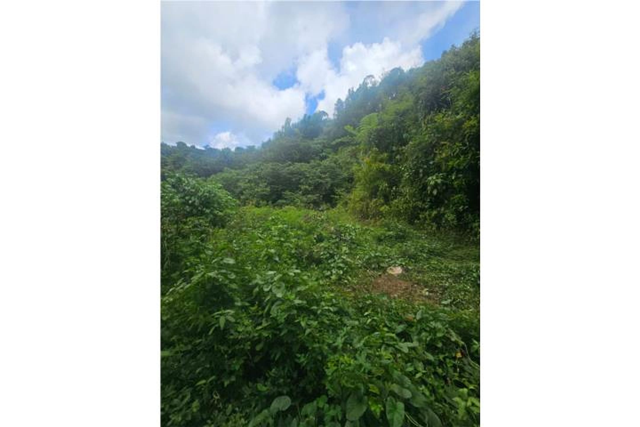
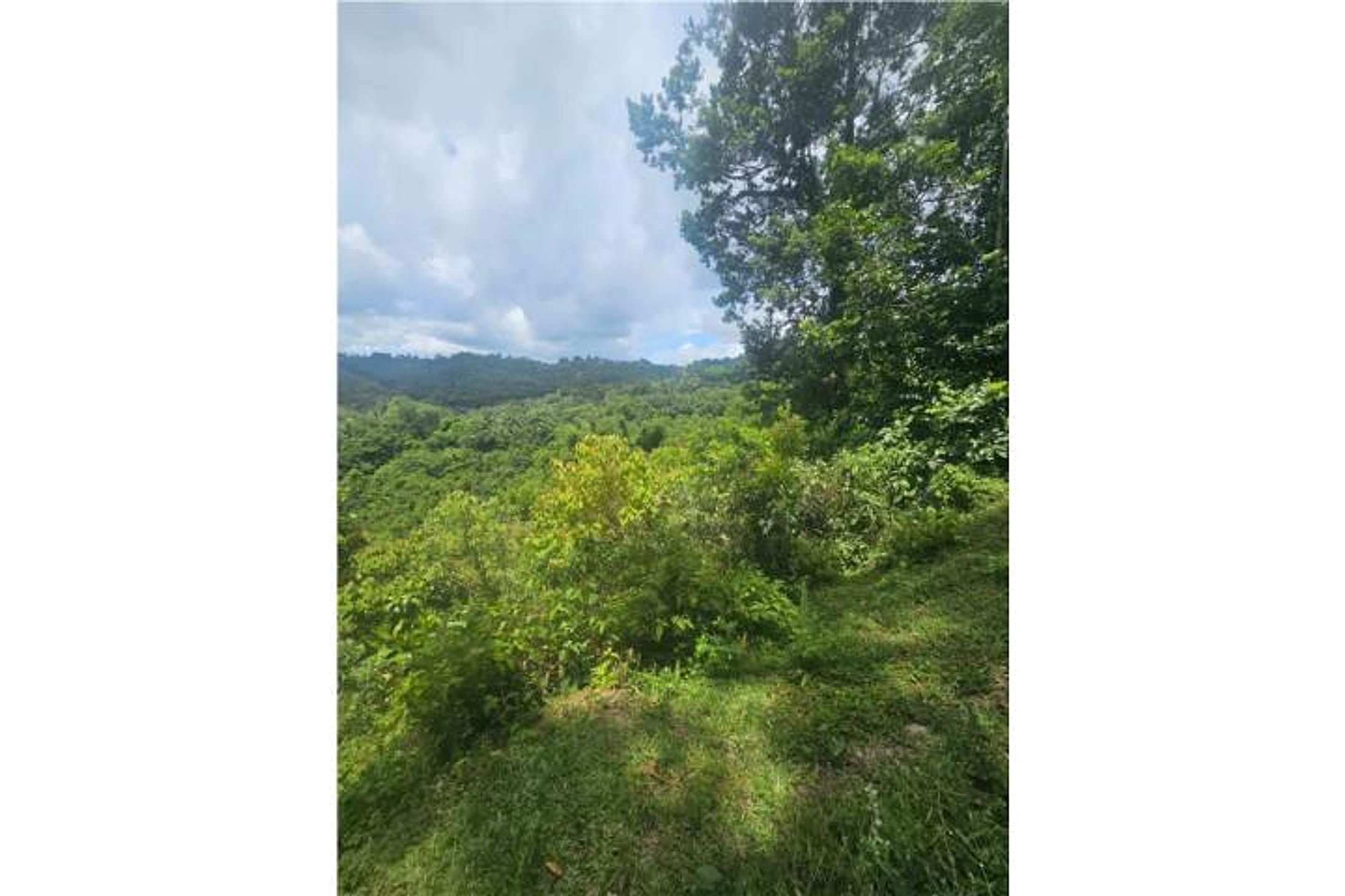
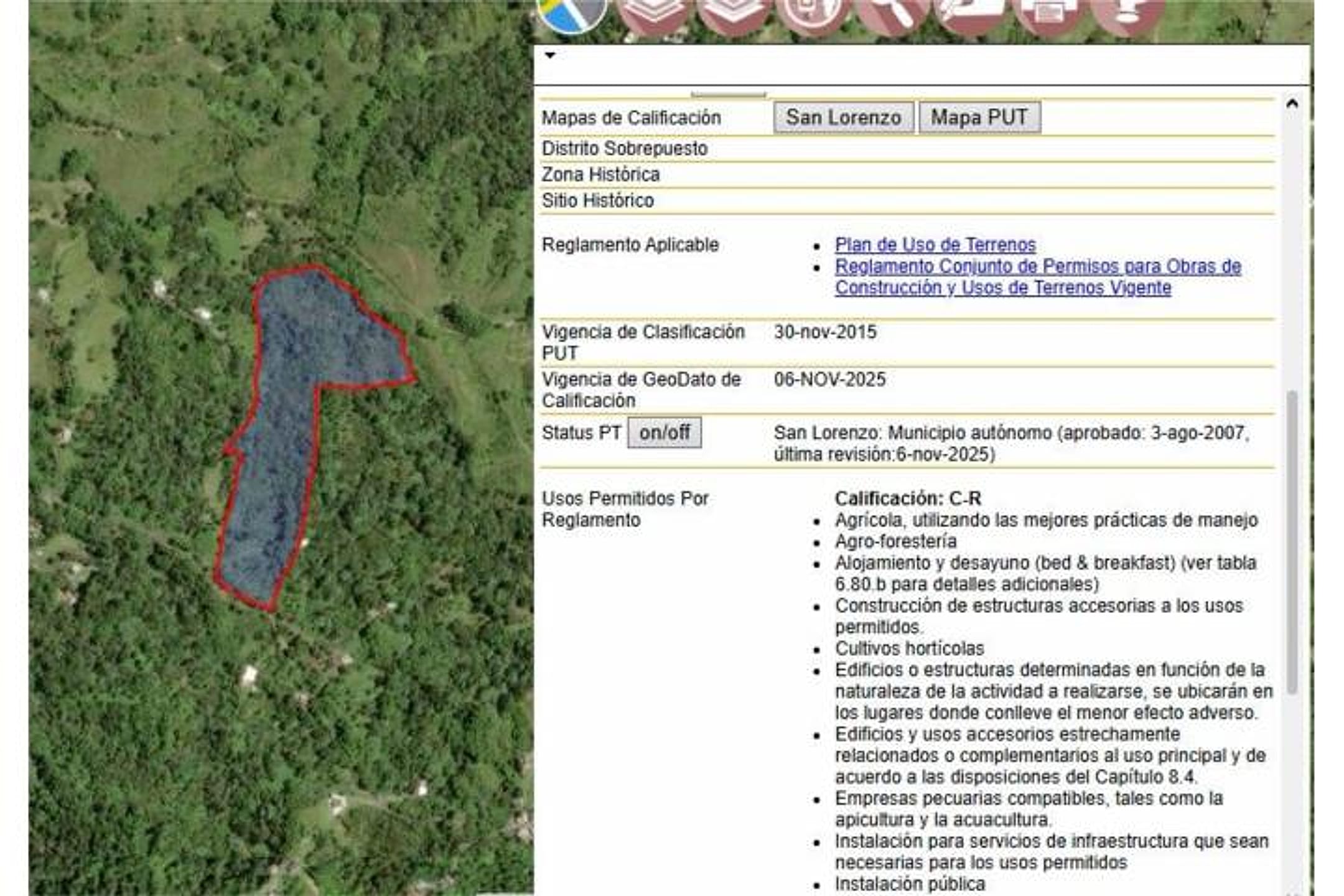
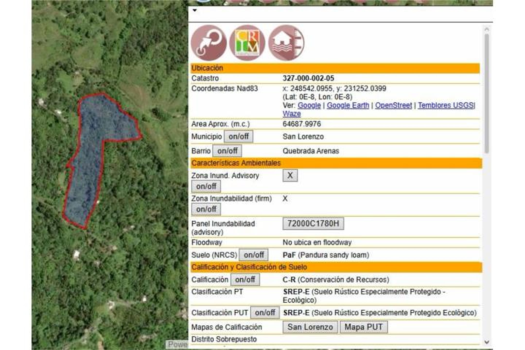
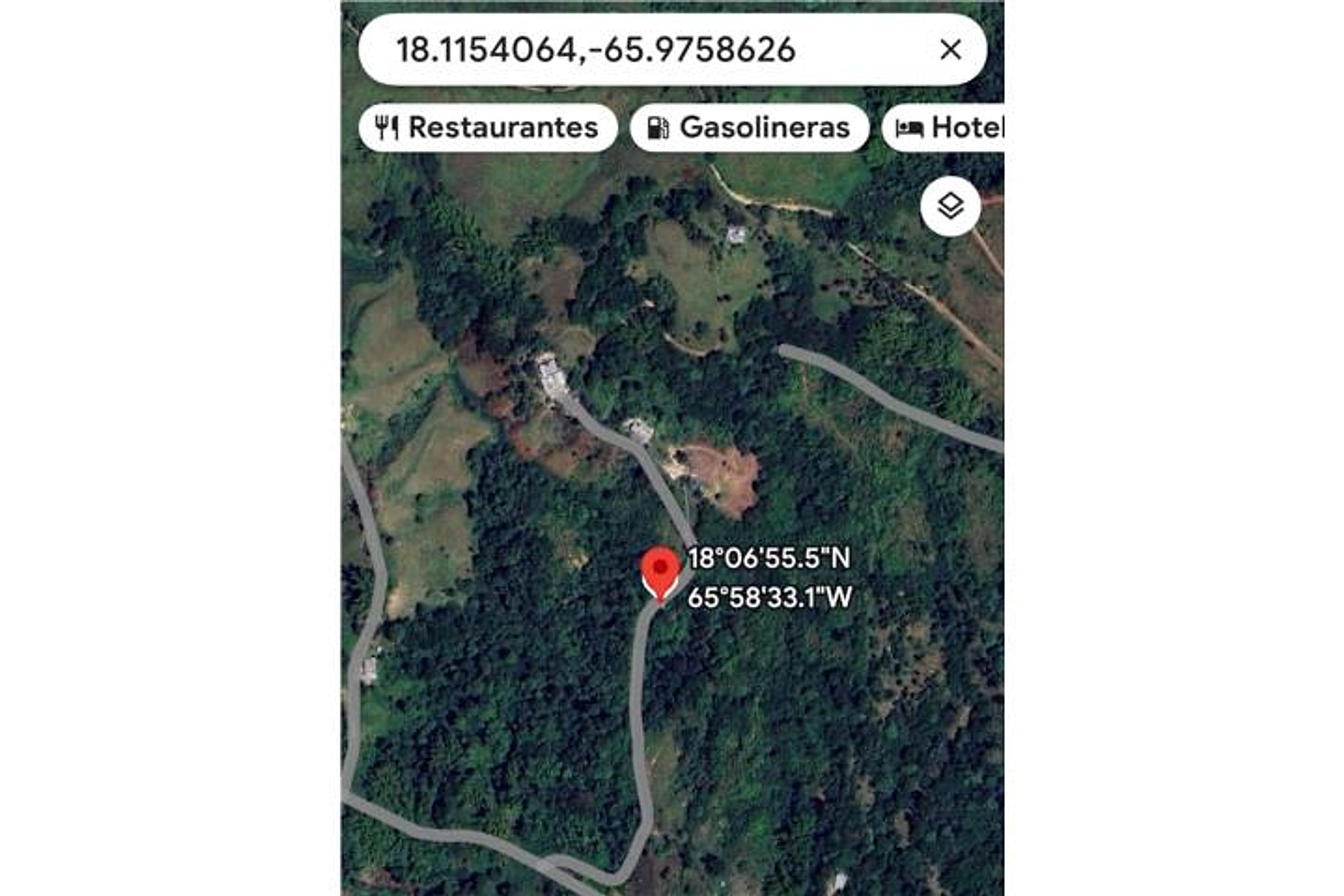
Photo 1 is a cadastre map showing the parcel outlined in orange against surrounding green (forest/vegetation). Photos 2–4 are ground-level shots of the property revealing dense, lush vegetation with no visible structures, cleared understory in places (Photos 2–3), and tall forest canopy (Photo 4); terrain appears relatively level to gently sloping in the cleared sections, with no panoramic views visible from ground level. Photo 5 is a classification/permit document for San Lorenzo. Photo 6 is a land-use summary table (appears to confirm agricultural zoning, SREP-E classification). Photo 7 is a map pin showing coordinates and nearby amenities (restaurants, gas stations, hotels) in the area. No structures, roads, water features, or ocean/mountain vistas are visible in the ground photos; vegetation is dense secondary forest with no discernible fruit trees.
Read from the listing photos by vision AI — verify against the images yourself.
| Location | Quebrada Arenas, San Lorenzo (tier 1 — ≤30 min of Humacao) |
|---|---|
| Price | $110,000 |
| Size | 15.54 acres (16 cuerdas) |
| Land $/acre | $3,539/acre (after $55,000 home credit) |
| Fit score | 58/100 |
| Existing home | yes — not move-in habitable |
Other things spotted in the photos
AI-read from the listing photos — unverified, eyeball against the actual photo before relying on it.
- Coordinates:
18.1154064, -65.9758626— Photo 7 map popup - Coordinates:
18°00'55.5"N 65°58'32.1"W— Photo 7 map location display - Note:
327 000 002 55— Photo 6 Ubicación field - Note:
Mapa PUT— Photos 5 and 6 classification maps reference
Location, terrain & flood
📍 Open in Google Maps — Quebrada Arenas, San Lorenzo, Puerto Rico 🛰 Satellite
⛰ 947 ft elevation 🌊 FEMA Zone X — minimal flood
Barrio-level pin (listings give barrio + municipio, not the exact lot) — verify the parcel location. Elevation: USGS. Flood zone: FEMA NFHL.
Drive times
| Miramar Bar | 33 min | 16.4 mi |
|---|---|---|
| Playa Lucía Disc Golf | 25 min | 10.8 mi |
| SJU Airport | 62 min | 37.3 mi |
| Costco (Caguas) | 31 min | 16.4 mi |
Buildability
Land is described as suitable for agricultural or residential development with existing utilities (water, electricity) and private spring. Verify zoning permits single-family residential, confirm road access is year-round passable, and check flood/landslide risk — San Lorenzo's northern interior can be steep/wet.
Due diligence — verify before buying
- Walk the property boundary and confirm the spring location, water flow rate, and legal right-of-way; verify utilities (water line, electricity pole) are actually accessible and functional.
- Obtain a recent survey and compare cadastre coordinates (Photo 1) to the actual ground markers; confirm no encroachments and road access is passable year-round.
- Inspect for landslide scars, drainage issues, or unstable slopes, especially given Hurricane María's impact on San Lorenzo in 2017; request local municipal records on slope stability and prior damage.
- Clarify why the listing says '16 acres' but cadastre/title shows 15.54 acres; confirm the discrepancy and ensure deed reflects the correct size.
- Meet with a local agricultural extension agent or forester to assess soil quality, existing vegetation value, and cost/timeline to clear and develop; no fruit trees or improved land are visible.
- Verify zoning permits and building restrictions (Photo 6 shows SREP-E classification); confirm residential or agricultural use is permitted and what infrastructure (septic, well, road frontage) is required.
What the web found
Quebrada Arenas is a real barrio in San Lorenzo located in the eastern-central region of Puerto Rico, with USGS monitoring stations and various residential/agricultural properties. The area is mountainous, with riverside access and nearby recreation. Similar land parcels in Quebrada Arenas and San Lorenzo range from ~$55k–$150k+ depending on size; hurricane/landslide risk noted historically.
Also found online:
- PropertyShark / FindItPR — Multiple land listings in Quebrada Arenas, San Lorenzo; 4-acre parcel noted as excellent development opportunity in barrio Quebrada
- TotalCommercial.com — 114 cuerdas (~111 acres) agricultural land in Quebrada Arenas Ward; also smaller vacant residential lots with lush greenery and scenic views
- FindItPR / Findit.pr — Recent San Lorenzo land listings including Carr PR 9920 Km 1.2 Bo Quebrada Arenas; 19.8 acres for $220k (Km 4.6); 84.78 acres for $1.42M
- Homes.com Puerto Rico — Lot#1-A Los Colones Sector Quebrada Arenas Ward, San Juan area; $85k for 23,522 sq ft land
Area intel: Quebrada Arenas is a rural, mountainous barrio with 2,390 residents (2010 census). Comparable land sales in San Lorenzo range from $55k–$220k+ for 0.9–19.8 acres. Terrain is mixed (hills, flat areas, gentle slopes); accessible via PR-181 and local roads. Significant hazard: Hurricane María (Sept 2017) triggered numerous landslides in San Lorenzo due to heavy rainfall. San Lorenzo is on a batholith (igneous rock formation) bordered by Sierra de Luquillo to north and Sierra de Cayey to south. Water resources available (Río Grande de Loíza, Quebrada Arenas wells monitored by USGS). Area used for agriculture, livestock, and increasingly residential/investment properties. No major news alerts for this specific address or sector.
Dig deeper
Original listingGoogle itGoogle MapsSatellite viewRealtor.com compsPR flood map (FEMA)Listing ID 4861977 · scored 2026-06-06 · keyword score, needs review