50 Cuerdas for Sale in Juncos
elevationprivaterainforest
Description from Clasificados
Vacant raw land comprising 48.56 acres (50 cuerdas). Located on State Road PR-31, Km. 21.3 in the Gurabo Arriba Ward, Municipality of Juncos, Puerto Rico (Latitude: 18.24378532, Longitude: -65.88572099). Property zoning: 57% B-1 (Interior Forests Area) and 43% A-D (Rural Developed Area), situated within SREP (Rustic Soil Especially Protected) and SRC (Common Rustic Soil) classifications. Permissible uses are primarily agriculture and preservation, with residential use of one or two family units permitted per tract exceeding 5 cuerdas. No structures or improvements noted.
Original Spanish
Land Size 48.56 Acres Zoning (B-1) 57%; (A-D) 43% Vacant raw land comprising an area of 50 “cuerdas”. The property is located State Road PR-31, Km. 21.3 in the Gurabo Arriba Ward of the Municipality of Juncos, Puerto Rico. The subject property is within zoning districts identified as SREP (Rustic Soil Especially Protected) SRC (Common Rustic Soil) with zone districts as A-D, (Rural Developed Area), 57% and B-1 (Interior Forests Area), 43%. Under SRC and SREP the permissible uses are mainly agriculture and ClasificadosOnline preservation, with some residential uses of one or two families residential units permitted per tract of land of more than 5 “cuerdas”. North of Road PR-31, Km. 21.4, Gurabo Arriba Ward Juncos, Puerto Rico Lat: 18.24378532, Lon: -65.88572099 https://totalcommercial.com/listings/48751 Puerto Rico
Why it's interesting
Elevation (858 ft) and rainforest vegetation are genuine assets; flood risk is minimal (FEMA X). However, the property is raw, landlocked (no visible water access or river frontage), offers no detectable ocean view, and lacks any identifiable fruit trees or structures. Road access is good, and privacy is plausible given the forest zoning, but the listing at $300,000 sits well above recent comparable sales ($105k–$240k for similar-sized parcels in the region), and the high upfront cost plus regulatory constraints (B-1/A-D zoning, SRP classification) and no improvements make it a speculative/long-term play rather than a move-in or quick-build scenario.
🔄 Refreshed with measured elevation/flood, the cadastre record, and the listing photos on 2026-07-01.
💵 Asking $300,000 for a raw, unimproved 50-cuerda parcel; recent comps in the region range $105k–$240k for 6.6–20+ cuerdas, suggesting this may be priced above current market. Last recorded sale data not provided; verify against cadastre records.
What the photos show
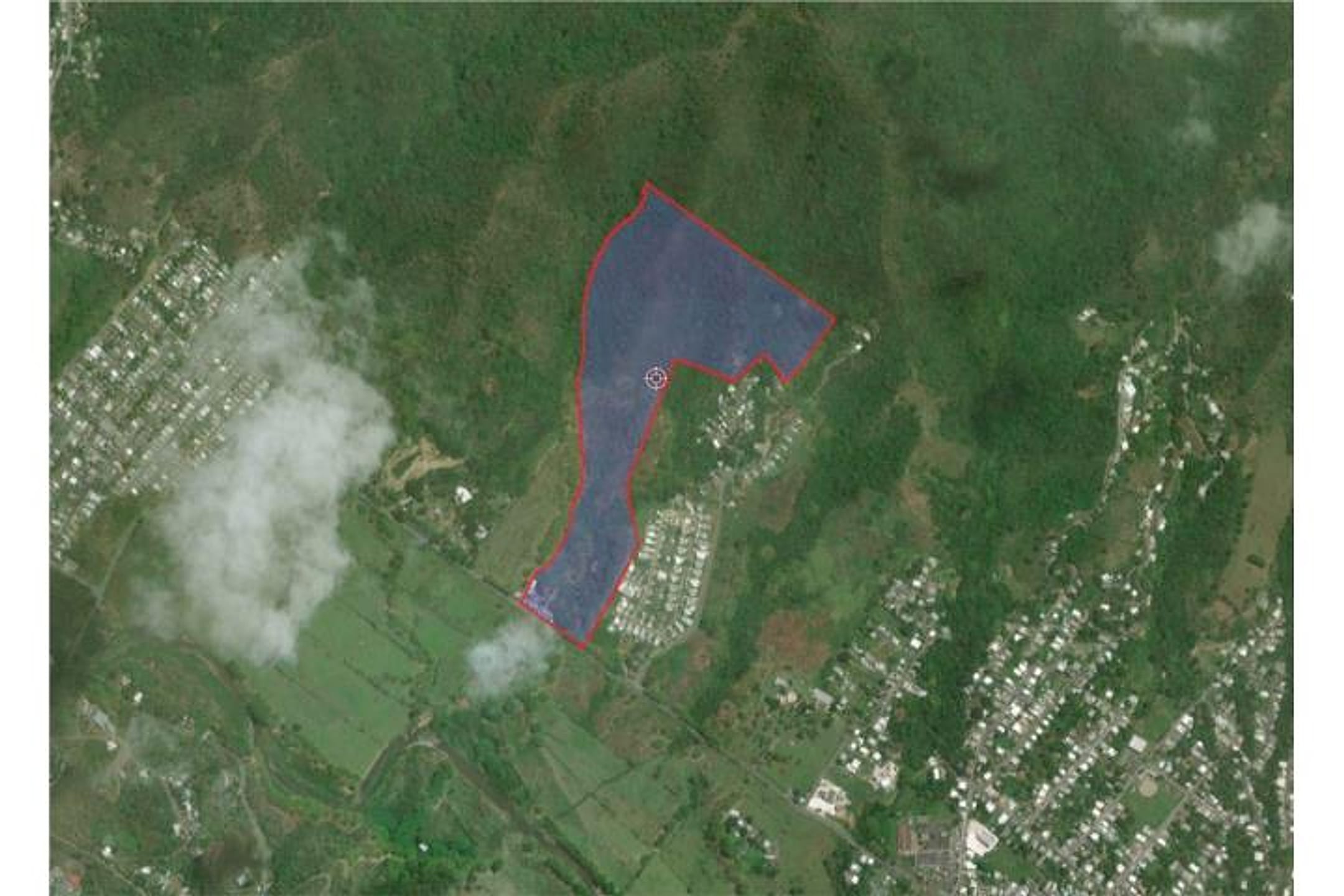
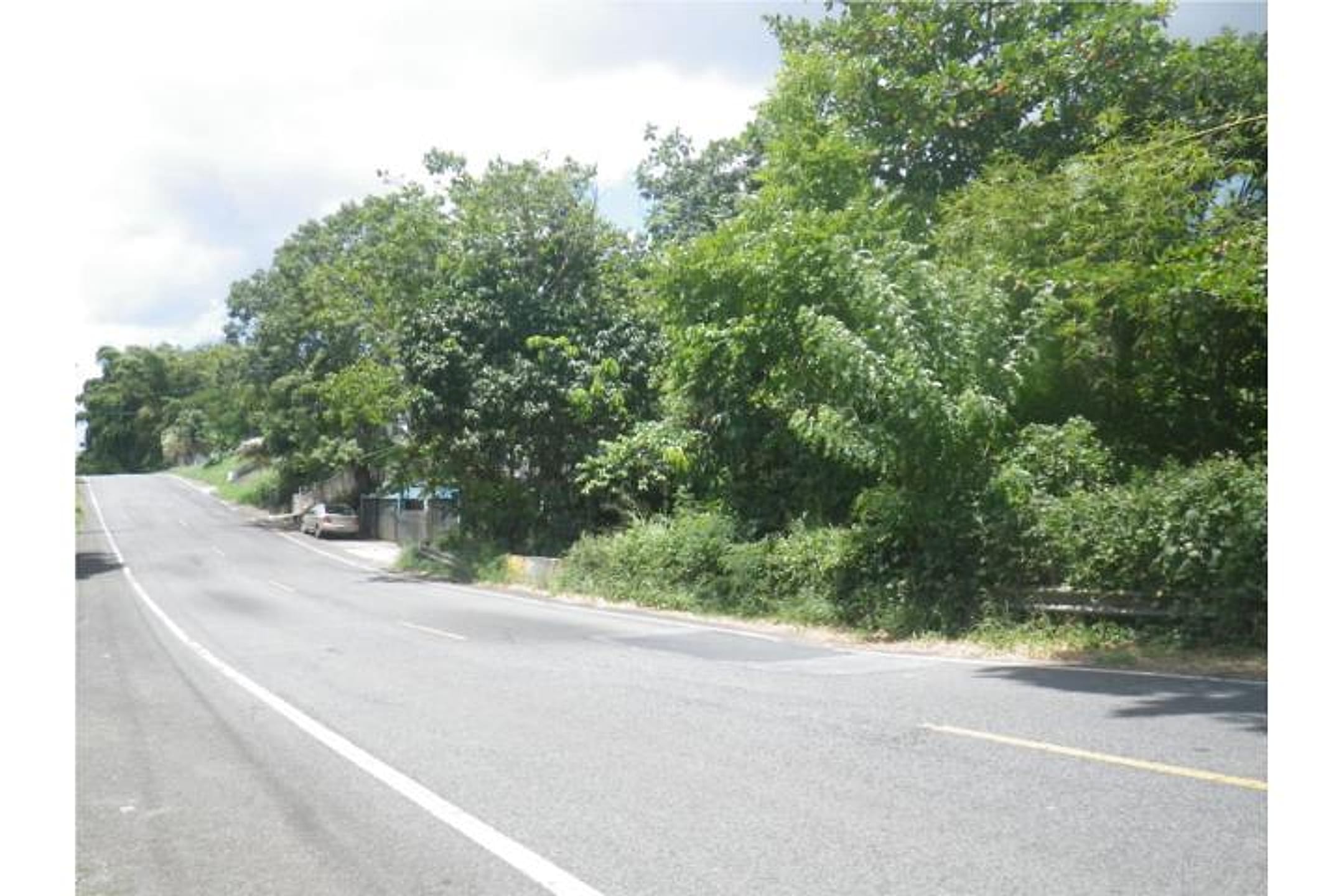
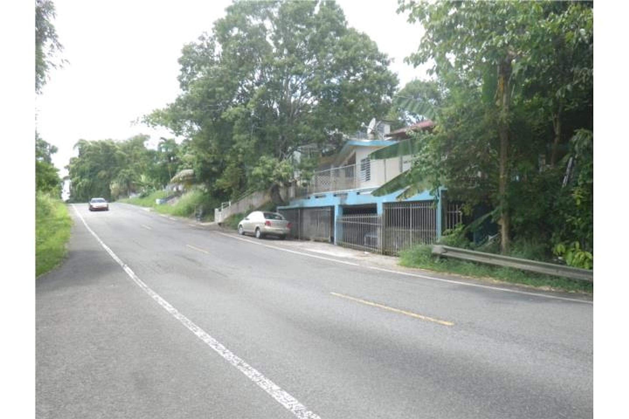
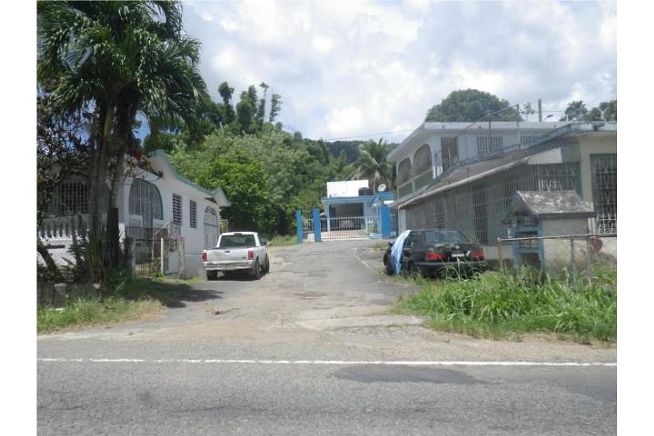
Photo 1 (aerial/cadastre map) confirms the parcel outline and dense vegetation coverage typical of interior forest zoning; no structures visible. Photos 2–4 show PR-31 frontage with lush tropical growth, mature trees lining the road, and modest residential structures nearby; the road itself is paved and well-maintained. Terrain appears relatively level along the roadside in photos 2–4, consistent with the 858 ft elevation. No ocean, river, or stream is visible in any ground-level photo; the property abuts roadway and adjoining residential/rural plots. Dense green canopy suggests rainforest character, but no fruit trees are distinctly identifiable. No active development or improvements on the raw land itself.
Read from the listing photos by vision AI — verify against the images yourself.
| Location | Gurabo Arriba, Juncos (tier 1 — ≤30 min of Humacao) |
|---|---|
| Price | $300,000 |
| Size | 48.56 acres (50 cuerdas) |
| Land $/acre | $6,178/acre |
| Fit score | 42/100 |
| Existing home | no |
Location, terrain & flood
📍 Open in Google Maps — Gurabo Arriba, Juncos, Puerto Rico 🛰 Satellite
⛰ 858 ft elevation 🌊 FEMA Zone X — minimal flood
Barrio-level pin (listings give barrio + municipio, not the exact lot) — verify the parcel location. Elevation: USGS. Flood zone: FEMA NFHL.
Drive times
| Miramar Bar | 28 min | 16.1 mi |
|---|---|---|
| Playa Lucía Disc Golf | 32 min | 20.9 mi |
| SJU Airport | 48 min | 25.7 mi |
| Costco (Caguas) | 21 min | 11.1 mi |
Buildability
Single-family residential permitted on tracts >5 cuerdas under SRC/SREP zoning. However, 43% of property is B-1 (Interior Forests Area), which may have stricter development restrictions. Proximity to PR-31 provides road access. No mention of utilities, flood zone, or survey—all must be verified. Agricultural/preservation zoning may require variance or environmental review.
Due diligence — verify before buying
- Confirm last recorded sale price and date for this specific parcel; compare $300,000 asking price to actual transaction history.
- Verify zoning B-1 (Interior Forest) and A-D (Rural Developed) split (57%/43%); clarify which portion(s) permit residential development and what site-plan approvals are required.
- Obtain hydrological survey to confirm absence of perennial streams, springs, or Río Gurabo flow affecting the land (listed web research notes flood risk from Río Gurabo during heavy rain).
- Conduct geotechnical and landslide-risk assessment; Juncos municipality has documented landslide hazards—confirm this specific parcel is outside high-risk zones.
- Walk the boundary to identify actual topography, road setback, and any easements or encroachments.
- Budget for forest clearing, site access roads, and utilities (water, power, septic) before estimating construction cost.
What the web found
Web searches confirm Gurabo Arriba is a barrio in Juncos at approximately 196 meters elevation. The area has been subject to hurricane damage, landslide risks, and flood concerns due to the Río Gurabo. No duplicate listings or agent contact info for this specific parcel were found online.
Area intel: Juncos municipality faces documented hazards including landslide risk in Valenciano Arriba ward and flood-proneness related to the Río Gurabo during heavy rainfall. Hurricane María (2017) and Fiona (2022) caused significant damage. Land in the region shows comparable sales ranging from approximately $65,000–$360,000 for varied parcels. Recent listings on FinditPR show land sales at $105,000–$240,000 for properties measuring 6.6–20+ cuerdas.
Dig deeper
Original listingGoogle itGoogle MapsSatellite viewRealtor.com compsPR flood map (FEMA)Listing ID 4306850 · scored 2026-06-06 · keyword score, needs review