50-Cuerda Land Parcel in Pozo Hondo, Guayama
elevationriverfrontprivaterainforest
Description from Clasificados
Approximately 50 cuerdas of land in Guayama, Puerto Rico, off PR-7707. Property has access to a 38 kVA AEE (power utility) line and water supply access. For more information call the Classified line at (787) 977-7373 or WhatsApp. You may also visit www.propertyconceptscommercial.com Puerto Rico.
Original Spanish
Aprox. 50 cuerdas de terreno en Guayama PR-7707. Propiedad tiene acceso a una línea AEE de 38 KVA y acceso a suministro de agua. Para más información llame Clasificados al (787) 977-7373 o escriba por WhatsApp. También puede visitar www.propertyconceptscommercial.com Puerto Rico
Why it's interesting
The property delivers on several loves—measured elevation (713 ft) is respectable, rainforest vegetation is evident in photos, a river/stream is visible on the boundary or nearby, and privacy is strong in a rural agricultural zone. However, no ocean view is apparent (Humacao coast is 10+ miles away), no fruit trees are identifiable at this resolution, and the rustic zoning severely limits residential development without variance. Price and last sale are unknown, so value cannot be assessed. The couple should expect to navigate permitting complexity.
🔄 Refreshed with measured elevation/flood, the cadastre record, and the listing photos on 2026-07-01.
What the photos show
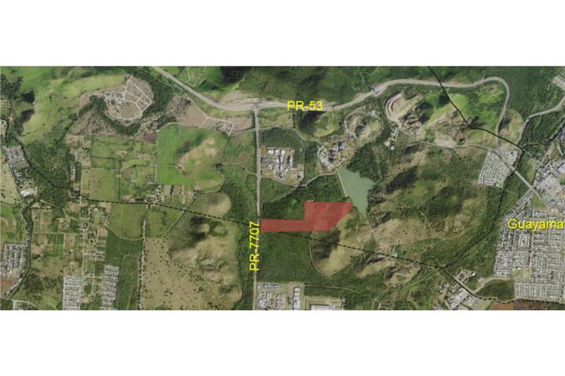
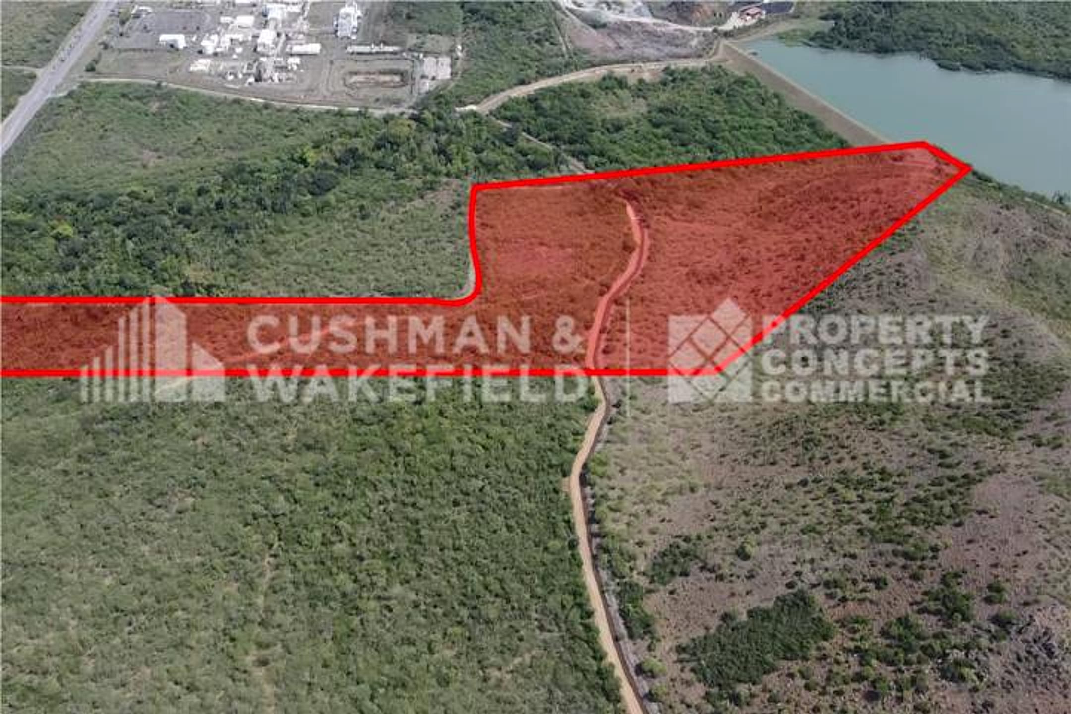
Photo 1 is a cadastre/aerial map showing PR-53 and PR-7707 road labels, indicating a large rural parcel with mixed land use (pasture, light forest patches, some cleared areas). Photo 2 is an aerial view of the same property showing a higher-elevation vantage: dense rainforest canopy dominates the eastern/northern portions, a cleared or lighter-vegetation zone in the western section (consistent with the red-outlined parcel), and a river or stream visible as a tan/light line running through forest in the upper right quadrant. No structures visible; road access appears adequate via labeled highways. Terrain is clearly undulating with elevation gain evident from the forest distribution and topography.
Read from the listing photos by vision AI — verify against the images yourself.
| Location | Barrio Pozo Hondo, Guayama (tier 2 — farther, “epic-only”) |
|---|---|
| Price | on request |
| Size | 48.56 acres (50 cuerdas) |
| Land $/acre | — |
| Fit score | 72/100 |
| Existing home | no |
Other things spotted in the photos
AI-read from the listing photos — unverified, eyeball against the actual photo before relying on it.
- Note:
PR-53— Road designation visible in image 1 - Note:
PR-2777— Road designation visible in image 1
Location, terrain & flood
📍 Open in Google Maps — Barrio Pozo Hondo, Guayama, Puerto Rico 🛰 Satellite
⛰ 713 ft elevation 🌊 FEMA Zone X — minimal flood
Barrio-level pin (listings give barrio + municipio, not the exact lot) — verify the parcel location. Elevation: USGS. Flood zone: FEMA NFHL.
Drive times
| Miramar Bar | 75 min | 41.9 mi |
|---|---|---|
| Playa Lucía Disc Golf | 64 min | 33.9 mi |
| SJU Airport | 99 min | 54.6 mi |
| Costco (Caguas) | 70 min | 35.1 mi |
Buildability
Size and utility access (AEE line, water supply) suggest buildability; however, no mention of road quality, flood zone, zoning class, or deed restrictions. Guayama inland areas are generally buildable but can have agricultural zoning limits.
Due diligence — verify before buying
- Confirm asking price and compare to ~$9,900–$12,800/cuerda comps; last recorded sale date/price unknown from listing.
- Verify zoning variance feasibility: property is SRC/A-4 (rustic/agriculture); residential single-family build may require formal change-of-use application and municipal approval.
- Survey the river/stream boundary: confirm ownership, riparian rights, and whether it qualifies as 'riverfront' (on-property water access vs. boundary only).
- Request title search and clear cadastral boundaries; confirm 48.56 acres matches the 50-cuerda listing claim.
- Validate AEE power and water access claims on-site; confirm line capacity for future residential use.
- Identify fruit trees or agricultural species on the parcel; if developing, clarify tree-removal or preservation requirements.
What the web found
Web searches reveal multiple large rustic land parcels listed in Barrio Pozo Hondo, Guayama, ranging from ~50 to 137+ cuerdas. Prices for comparable parcels in the area range from ~$9,919–$12,862 per cuerda. The area is zoned for agricultural/rustic use with good highway access (PR-53/PR-713) and sits in low-risk FEMA Flood Zone X, though building restrictions apply due to rustic zoning classification.
Also found online:
- HometrustRealtyGroup.com — 137.741-cuerda parcel, MLS #PR9120386, priced at $1,744,000 (~$12,862/cuerda); multiple sub-parcels
- RE/MAX Dorado — 103-cuerda parcel in Pozo Hondo with PR-713 access, FEMA Zone X, A-4 agricultural zoning, approved preliminary project
- FinditPR.com — Multiple Pozo Hondo parcels: ~103 cuerdas at $1,195,000 and ~92.667 cuerdas at $1,495,000 on Rd 713
- ByOwner.com — Pozo Hondo listings: Lot 19 (90 acres at $1,495,000); Lot 20 (100 acres); PR-3 area (141 acres at $14,600,000)
Seller / agent: Agent/seller names not found for specific ClassificadosOnline ID 4116741; HometrustRealtyGroup and RE/MAX Dorado appear as listed brokers for comparable Pozo Hondo parcels
Area intel: Pozo Hondo is a rural barrio (pop. ~1,263 in 2010) zoned primarily SRC (Common Rustic Soil) or A-4 (General Agriculture). Comparable 50+ cuerda parcels in 2025–2026 range $1.2–$1.7M (roughly $9,900–$12,800 per cuerda). Land is within FEMA Flood Zone X (low flood risk). Area has good access to PR-53 expressway. Buyer advisories note: rustic zoning limits residential development; due diligence required on permits and change-of-use applications; property intended for large-scale agriculture, industrial, or development projects, not typical single-family home builds without zoning variance.
Dig deeper
Original listingGoogle itGoogle MapsSatellite viewRealtor.com compsPR flood map (FEMA)Listing ID 4116741 · scored 2026-06-06 · keyword score, needs review